


It was a cold one for Thanksgiving as temperatures struggled to climb out of the low 30s.
Friday stays cold even with some sunshine. Highs reach the mid-30s, and although the wind eases a bit, it will still feel crisp. Some spots may wake up to single-digit wind chills.
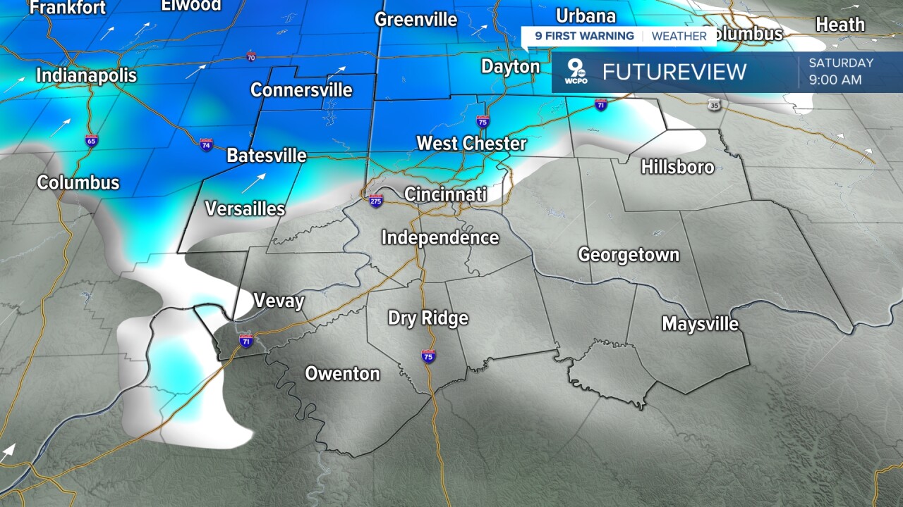
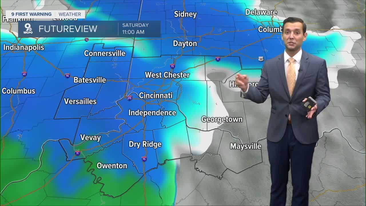
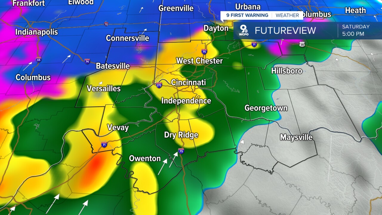
The weekend forecast is where things get interesting. A developing area of low pressure is heading our way, and forecast models have bounced back and forth between a snowy Saturday and a rainy Sunday.
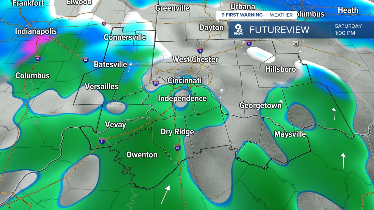
For now, the first wave of moisture early Saturday looks cold enough to start as snow. As temperatures rise later in the day, that snow should mix with rain and eventually change to all rain through the afternoon and evening.
The details may shift as new data comes in, so it is a good idea to stay tuned and stay weather aware heading into the weekend.
THANKSGIVING
Mix clouds & sunshine
Windy
High: 38
THURSDAY NIGHT
Mostly clear
Light wind
Low: 21
FRIDAY
Mostly sunny
Cold
Highs: 34
FRIDAY NIGHT
Increasing clouds
Freezing
Low: 20
9 First Warning Weather 24/7 Livestream
==========
- Interactive Radar: Track weather to your doorstep
- Sign up for severe weather email alerts
- Check latest school closings and delays
- WCPO traffic updates
- Metro bus detours and updates (or call the hotline at 513-632-7538)
- Latest power outages from Duke Energy
- Flight cancellations and delays from CVG, other U.S. airports
