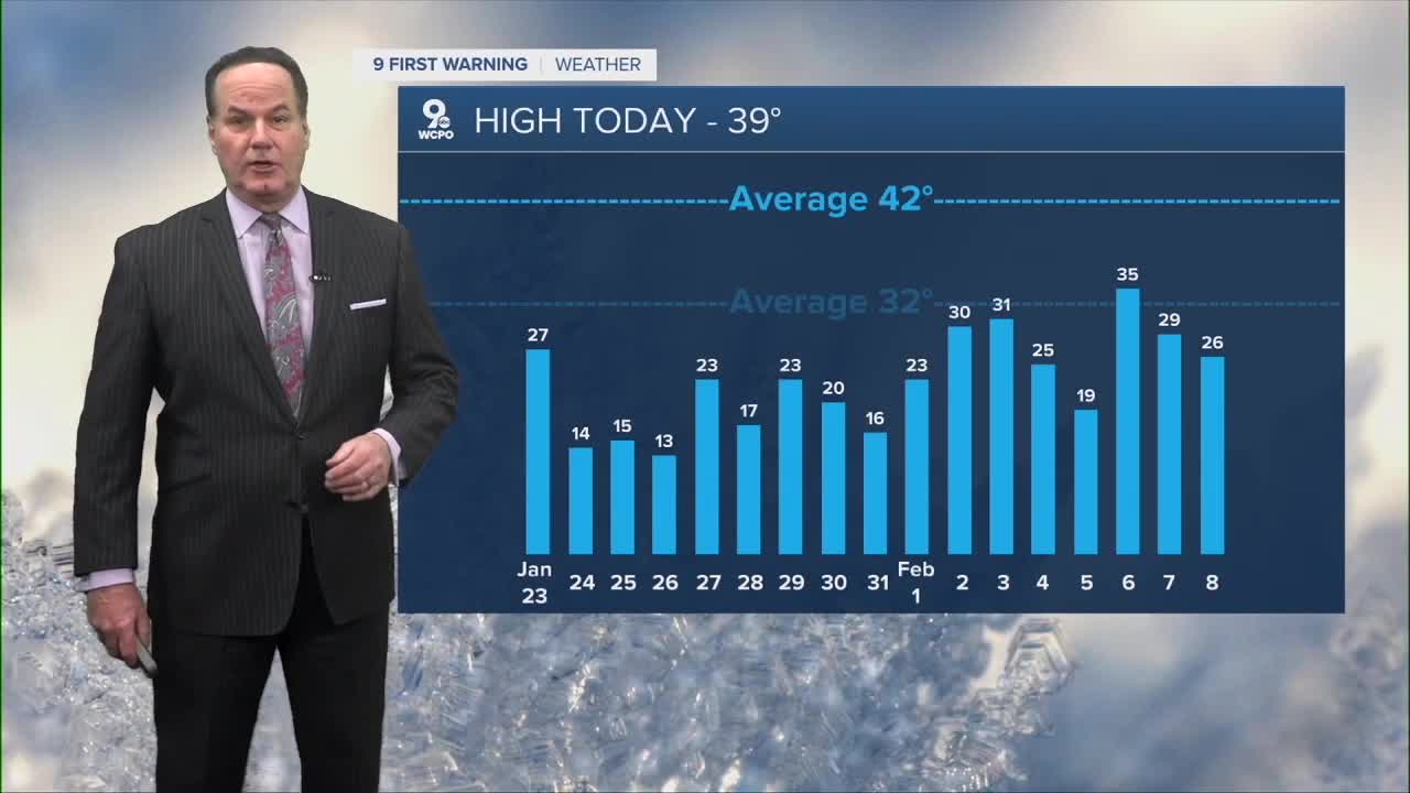


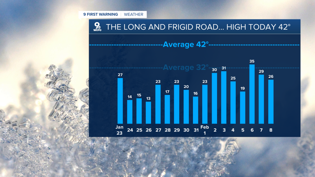
After a long stretch of arctic cold weather, the pattern is shifting into something much more seasonal over the next week. This change means temperatures will be closer to what we’d expect in mid-February rather than the deep freeze we’ve been accustomed to.
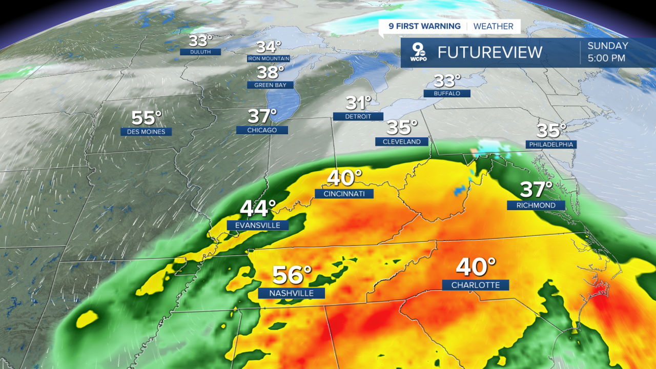
Instead of bundling up like it’s the dead of winter every day, the thermometer will start flirting with the low 50s and even warmer spots tomorrow, making it feel a bit more like early spring than the heart of winter. Nights will still be cold, seasonal, but nothing like the bitter single digits we’ve seen.
Wednesday and Thursday will see temperatures dip back toward the 30s and low 40s with more clouds. Even here, though, the pattern stays seasonal rather than record-breaking cold.
As we cruise into the weekend, that seasonal story continues. Saturday should feel mild with highs in the mid 40s, and Sunday will be about the same. With the warmer air aloft, rain chances increase this weekend, especially Sunday, when periods of showers are possible.
In short, we’re leaving the deep freeze in the rear-view mirror for at least the next nine days, swapping it for more seasonal highs, occasional clouds, and some rain chances late in the week and over the weekend. Stay tuned for any timing or intensity updates, especially for weekend rain.
OVERNIGHT
Partly cloudy
Patchy fog possible
Low: 28
TUESDAY
Mostly cloudy
Spotty sunshine
High: 51
TUESDAY NIGHT
Partly cloudy
Dry
Low: 28
9 First Warning Weather 24/7 Livestream
==========
- Interactive Radar: Track weather to your doorstep
- Sign up for severe weather email alerts
- Check latest school closings and delays
- WCPO traffic updates
- Metro bus detours and updates (or call the hotline at 513-632-7538)
- Latest power outages from Duke Energy
- Flight cancellations and delays from CVG, other U.S. airports
