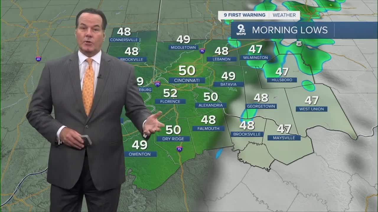


After a seasonal day with highs in the mid-60s (Cincinnati 64°), we'll see another seasonal day for Tuesday, but it could start wet for some. A weak cold front will swing through the area before daybreak, it will certainly bring mostly cloudy skies for a few hours until about 7-8 am. Plus, isolated neighborhoods could see a passing shower. Morning lows will start in the upper 40s to low 50s during that time.

Tuesday again will see afternoon highs reach the low to mid 60s, but the rest of the week will be cool. You'll notice that my highs will be several degrees below average. In fact, we'll see a couple of frosty mornings like Wednesday & Thursday.

While it'll be chilly and windy this week, it'll stay dry...until the weekend. Right now, both long-range models show chances for rain, but the timing is different. I've kept a chance for showers for both Saturday and Sunday until we see more unification through the week.
Bearcat & Bengal fans need to stay aware of the forecast this week.
TONIGHT
Mostly clear
Increasing clouds overnight
Low: 50
TUESDAY
Chance of rain before daybreak
Mostly Sunny & windy
High: 65
TUESDAY NIGHT
Mostly clear
Chilly
Low: 44
9 First Warning Weather 24/7 Livestream
==========
- Interactive Radar: Track weather to your doorstep
- Sign up for severe weather email alerts
- Check latest school closings and delays
- WCPO traffic updates
- Metro bus detours and updates (or call the hotline at 513-632-7538)
- Latest power outages from Duke Energy
- Flight cancellations and delays from CVG, other U.S. airports
