


A few clouds may filter in but overall we should stay mostly clear into the morning when we see lows in the id 50s. This is following a gorgeous yesterday with a high that hit 76 degrees.
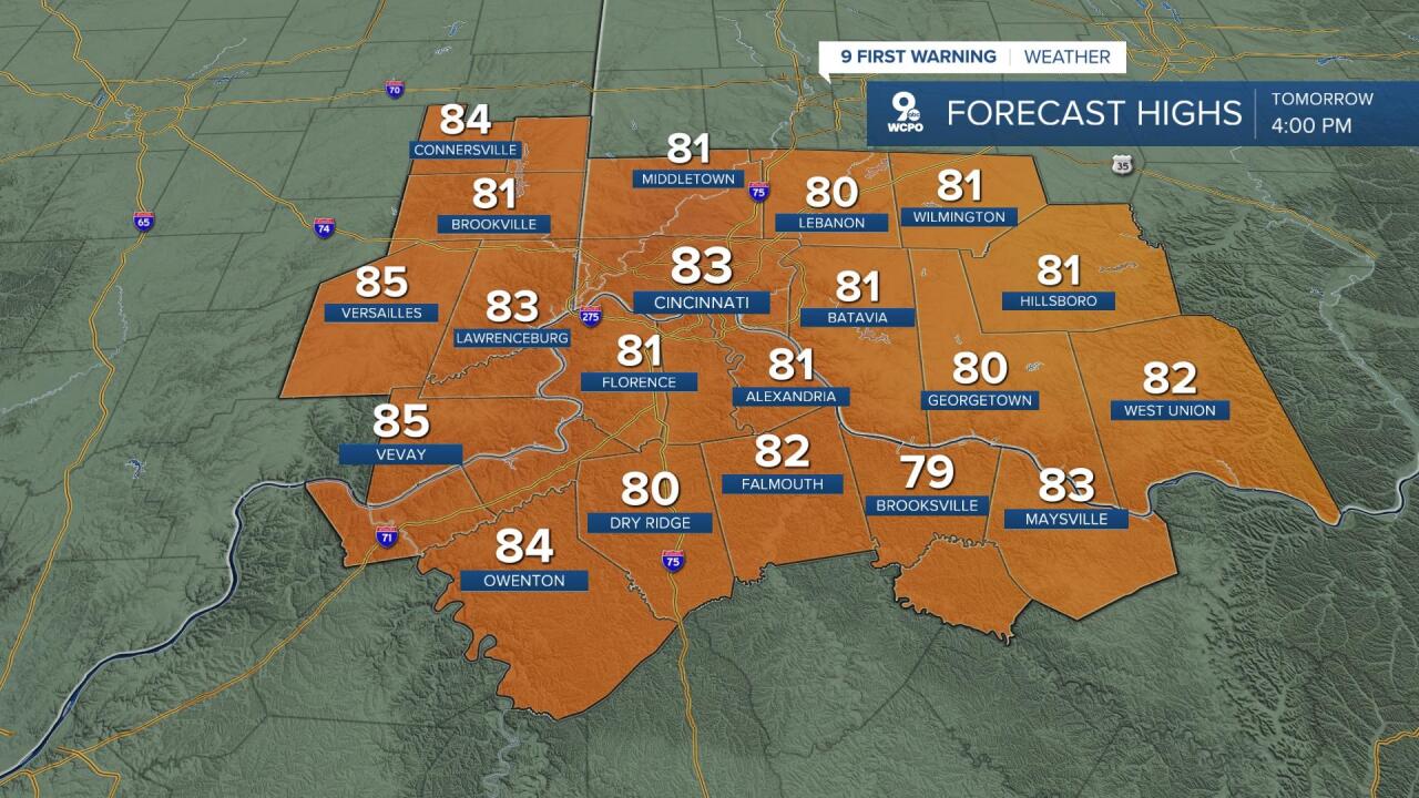
Tuesday will be the first of a number of days in the 80s. Overall, the week will be mixed with a both some sun and clouds with generally mostly sunny conditions. Highs will range from 82° to 87° through the rest of the week. This is the first 5-day stretch of 80s we have seen since early September.
One consequence of the long dry stretch, it's a big increase in pollen/allergen levels. Without any significant chance for rain this week, high pressure will trap the particulates and lead to high levels. Scattered rain and storms will be possible Saturday and, more likely, on Sunday.
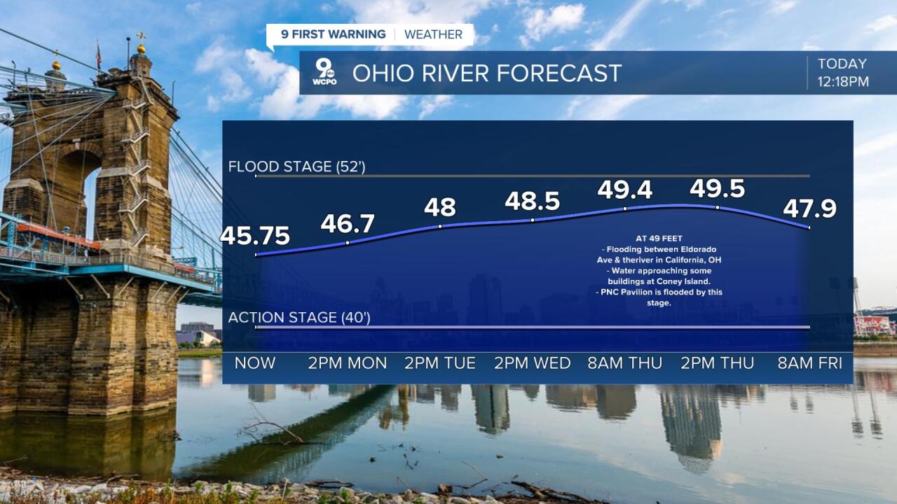
OHIO RIVER UPDATE:
We do have to watch the river level this week as water continues to rise in result of last week's storms. The crest isn't expected until Thursday morning near 49'. That is still below flood stage, but that doesn't mean we won't see some areas with flooding.
OVERNIGHT
Mostly clear
Staying mild
Low: 55
TUESDAY
A few clouds
Mostly Sunny
High: 83
TUESDAY NIGHT
A few clouds
Staying mild
Low: 60
WEDNESDAY
Nice & warm
Partly cloudy
High: 85
THURSDAY
Summer-like
Very warm
Low: 84
9 First Warning Weather 24/7 Livestream
==========
- Interactive Radar: Track weather to your doorstep
- Sign up for severe weather email alerts
- Check latest school closings and delays
- WCPO traffic updates
- Metro bus detours and updates (or call the hotline at 513-632-7538)
- Latest power outages from Duke Energy
- Flight cancellations and delays from CVG, other U.S. airports
