

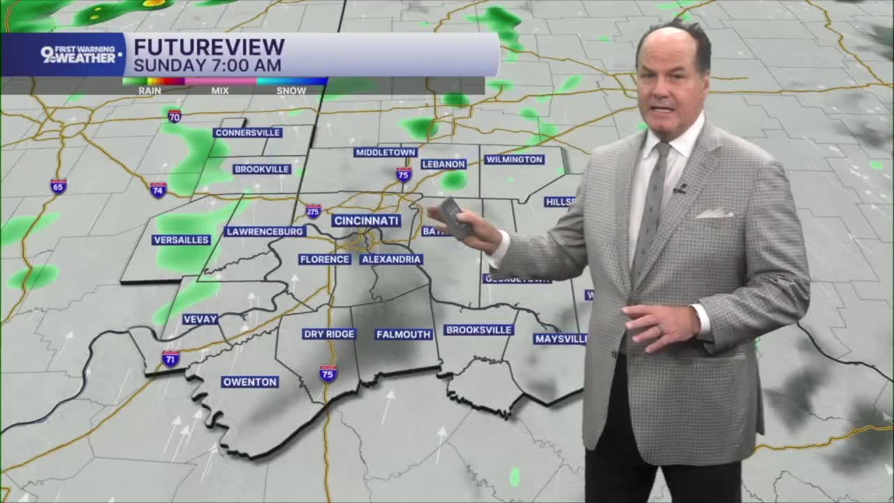


We’re wrapping up a quiet Friday, but the weather pattern is about to change as high pressure slides away and opens the door for a much wetter weekend. There's a chance for an isolated shower before heavy rain hits around the 8- 9 a.m. hour.
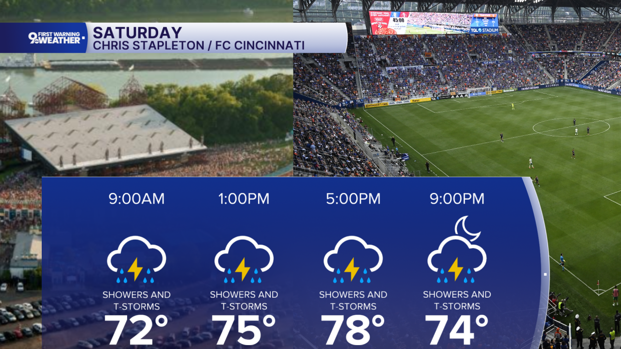
Saturday starts with showers or thunderstorms early, but rain becomes more widespread through the mid-morning and into the early afternoon. Expect highs in the upper 70s to low 80s with periods of rain, thunderstorms, and locally heavy downpours. Around a half inch to three-quarters of an inch of rain is possible during the day, and a few storms could become strong.
In fact, the Storm Prediction Center has placed us in a “Marginal Risk” for severe weather, category 1 out of 5. Showers and thunderstorms continue Saturday night, adding another quarter to around a half inch of rain in many spots before activity briefly eases late at night.

Sunday stays unsettled as another round of showers and thunderstorms develops, especially from late morning through the afternoon. Highs will again reach the upper 70s to low 80s, but clouds and repeated rainfall will keep temperatures from climbing much higher. Heavy rain remains possible in stronger storms before showers gradually diminish Sunday night.

By Monday, the overall trend turns a little quieter with a mix of clouds and some sunshine, although a few afternoon or evening showers and thunderstorms could still pop up. Tuesday brings more sunshine and warmer temperatures, climbing into the mid-80s, but don’t put the umbrella away just yet. A few spotty afternoon showers remain possible as the slow-moving weather system lingers nearby before gradually pulling away later in the week.
OVERNIGHT
Mostly cloudy
Chance showers
Low: 67
SATURDAY
Showers and storms
Heavy rain at times
Marginal Risk of severe weather
High: 79
SATURDAY NIGHT
Spotty showers
Mostly cloudy
Low: 67
SUNDAY
Scattered showers and isolated storms
Mostly cloudy
High: 80
9 First Warning Weather 24/7 Livestream
==========
- Interactive Radar: Track weather to your doorstep
- Sign up for severe weather email alerts
- Check latest school closings and delays
- WCPO traffic updates
- Metro bus detours and updates (or call the hotline at 513-632-7538)
- Latest power outages from Duke Energy
- Flight cancellations and delays from CVG, other U.S. airports
