


Clouds start to move back in overnight and into Wednesday morning, keeping us a bit warmer. We'll start the day in the upper 30s. Even with a mix of clouds and sun, the warm-up continues into the upper 60s for Monday afternoon.
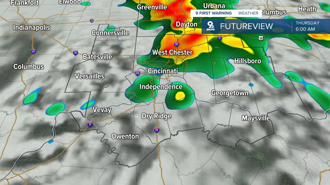
As for OPENING DAY, rain is likely on Thursday, but it's all about timing, and this could actually work out nicely for the Reds and us!
Thursday morning starts with scattered showers, but the rain should move out of Greater Cincinnati by late morning. This leaves us dry for the Findlay Market Opening Day Parade with temperatures in the upper 60s at noon. The sunshine should also start to come out during the parade.
The wind will be blowing in from the southwest, up to 30 mph, helping to blow in even warmer weather. This helps us warm up into the upper 70s around first pitch at 4:10, with a high near 80°

Eventually, a cold front will move in, bringing a line of thunderstorms through our area. It still looks like the storms won't enter our very northern locations until about 10 p.m. and closer to the metro by 11 p.m. or midnight. Rain will continue at times overnight and into Friday morning.

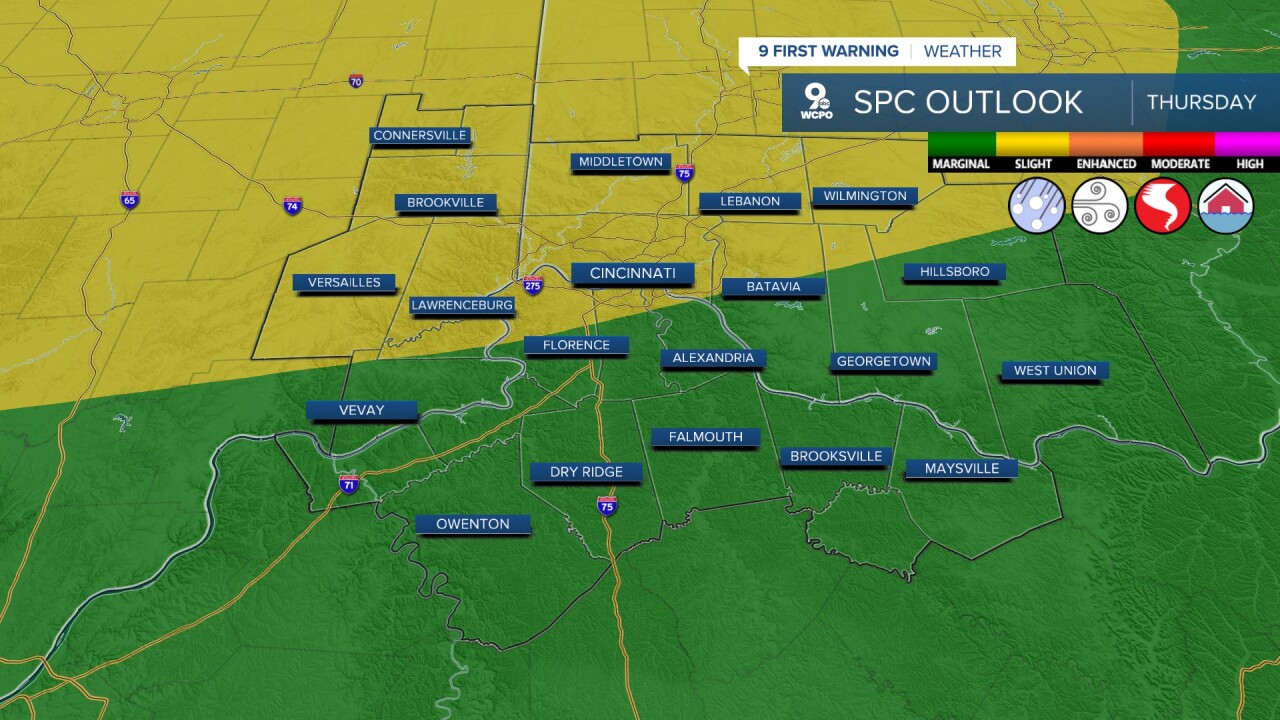
The Storm Prediction Center (SPC) has included our area in a risk for severe storms late Thursday. A "slight risk" is along the Ohio River and to the north. The storms will weaken as they push farther south, so areas farther south are in a "marginal risk" of severe storms. Damaging wind will be our main concern if any storms reach severe levels, but a couple of pockets of hail and a short-lived tornado are also possible.
It will be much cooler on Friday with temperatures dropping into the upper 40s for the afternoon.
Saturday looks mostly sunny with low 50s, then we rebound closer to 60 on Sunday.
The 60s continues for the first half of next week with rain looking likely on Tuesday.
OVERNIGHT
Mostly cloudy
Dry
Low: 39
WEDNESDAY
Mix clouds & sun
Warmer
High: 68
WEDNESDAY NIGHT
Mostly cloudy
Warmer
Low: 56
9 First Warning Weather 24/7 Livestream
==========
- Interactive Radar: Track weather to your doorstep
- Sign up for severe weather email alerts
- Check latest school closings and delays
- WCPO traffic updates
- Metro bus detours and updates (or call the hotline at 513-632-7538)
- Latest power outages from Duke Energy
- Flight cancellations and delays from CVG, other U.S. airports
