

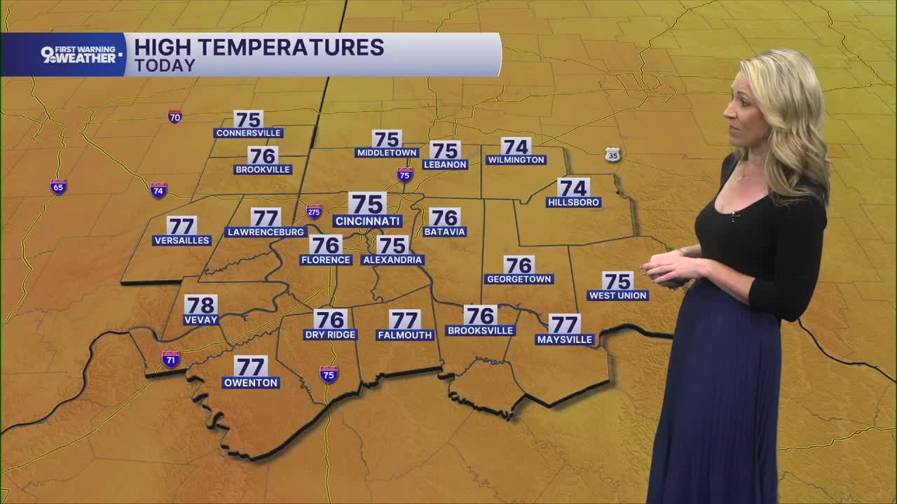


We had a stunning weekend here in the Tri-State with ample sunshine and we aren't done with the stretch of ideal Fall days.
Temperatures start in the low 50s this morning under a clear sky. We'll see sunshine again today and temperatures will warm to around 75 degrees. A light north at 5 mph is expected. This is a repeat of Sunday's forecast.
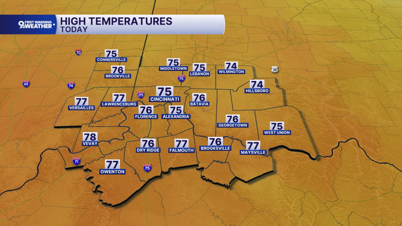
High pressure is still centered over the Ohio Valley on Tuesday and this ensures that we'll see another day of sunshine. Highs increase a bit to 77 degrees and winds will shift to the southeast at 5 mph.
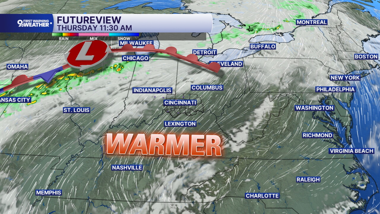
Winds will continue to stream in from the south on Wednesday and Thursday and this will lead to a decent temperature climb. Highs will warm to 84 and 87 on those days.
The reason we are warming is due to an area of low pressure coming our way from the Midwest. This will bring back scattered showers and storms on Friday and into Saturday's forecast too. But for our Fall lovers, it also ensures another drop in temperatures. We'll get back to highs in the upper 60s next week.
MORNING RUSH
Clear sky
Cool
Low: 52
MONDAY
Sunshine
Pleasant, seasonal
High: 75
MONDAY NIGHT
Clear and dry
Cool
Low: 51
TUESDAY
Sunny
A bit warmer
High: 77
TUESDAY NIGHT
Clear sky
Dry
Low: 52
9 First Warning Weather 24/7 Livestream
==========
- Interactive Radar: Track weather to your doorstep
- Sign up for severe weather email alerts
- Check latest school closings and delays
- WCPO traffic updates
- Metro bus detours and updates (or call the hotline at 513-632-7538)
- Latest power outages from Duke Energy
- Flight cancellations and delays from CVG, other U.S. airports
