


Heading to daybreak, the weather stays pretty mild, with a slight chance of showers and thunderstorms and a low of mid-60s. Wet weather will continue off & on throughout the day, and we could use it.

Rain will be heavy at times, and thunderstorms will stay isolated with highs in the upper 70s. A strong cold front will push across the area, and while some strong to severe storms are possible, that threat looks focused mainly across the eastern part of the forecast area and depends on the exact timing of the front.
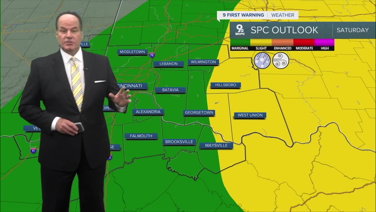
We have a “Marginal Risk” over most of the Tri-State, although east of Greater Cincinnati, there’s a “Slight Risk”, a level two out of five category. If any severe weather pops up, damaging winds would be the primary severe weather threat.

By Saturday night, rain chances ease, with lows in the low to mid 40s. Sunday turns much cooler behind the front, with sunny skies and highs in the upper 50s to low 60s. One important point for Monday morning, temperatures will start in the low to mid 30s, so cover up those plants.
Early next week looks cooler and quieter overall, with sunny skies and highs in the low 60s, then a warmer trend into Tuesday and Wednesday.
OVERNIGHT
Mostly Cloudy
Chance Showers
Low: 65
SATURDAY
Rain-heavy at times
Isolated Thunderstorms
Small chance for severe weather
High: 75
SATURDAY NIGHT
Rapidly falling temperatures
Drying out
Low: 42
SUNDAY
Cooler
Partly cloudy
High: 58
9 First Warning Weather 24/7 Livestream
==========
- Interactive Radar: Track weather to your doorstep
- Sign up for severe weather email alerts
- Check latest school closings and delays
- WCPO traffic updates
- Metro bus detours and updates (or call the hotline at 513-632-7538)
- Latest power outages from Duke Energy
- Flight cancellations and delays from CVG, other U.S. airports
