


After dropping below zero Monday morning, it won't be as frigid heading into Tuesday morning. It will still be cold, though, with most of us waking up to temperatures in the teens.
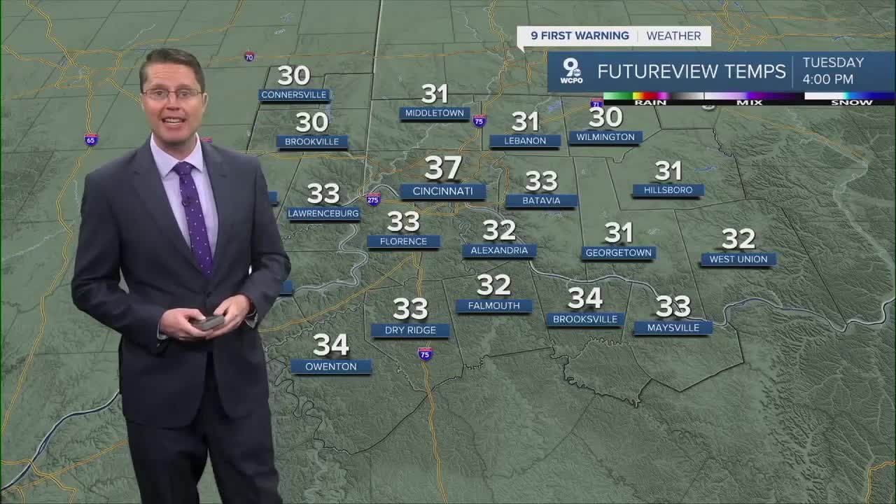
We warm up nicely in the afternoon with a lot of sunshine. Around the lunch hour, we push back above freezing, then we warm into the upper 30s late in the afternoon.
We’ll add a few more clouds Wednesday, but the warm-up continues. Temperatures get back to average for the middle of December with mid 40s.
A cold front moves in from the west on Thursday, bringing rain into the Tri-State as early as the morning commute. Rain becomes more likely in the afternoon then continues the rest of the day. Ahead of the cold front, warmer air blows in, pushing highs into the low 50s.

Behind that cold front, colder air and gusty winds return to finish out the workweek. Before the rain ends Thursday night, we could see some of the rain change into snow. Right now, it looks like none of that would stick or cause any problems.
The stronger wind will continue to blow in colder weather Friday. We'll see a mix of sun and clouds with highs in the low 30s.

Looking ahead to the weekend, we warm back into the 40s. Another round of rain looks possible late Saturday night into Sunday morning, but there will still be plenty of dry time.
The mid 40s continue with Monday and Tuesday with just a slight chance for rain.
OVERNIGHT
Mostly clear
Very cold
Low: 17
TUESDAY
Mostly sunny
Above freezing
High: 37
TUESDAY NIGHT
Partly cloudy
Chilly
Low: 32
WEDNESDAY
Partly cloudy
Back to average
High: 44
9 First Warning Weather 24/7 Livestream
==========
- Interactive Radar: Track weather to your doorstep
- Sign up for severe weather email alerts
- Check latest school closings and delays
- WCPO traffic updates
- Metro bus detours and updates (or call the hotline at 513-632-7538)
- Latest power outages from Duke Energy
- Flight cancellations and delays from CVG, other U.S. airports
