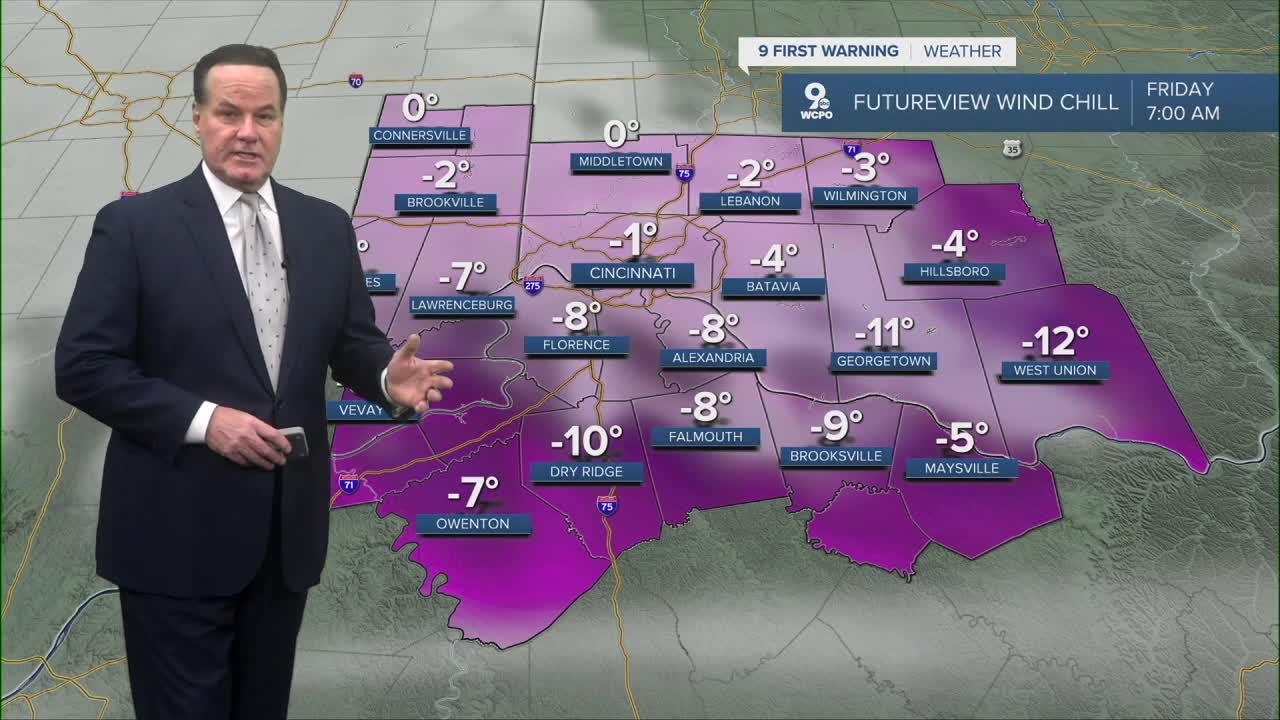


Over the next several days in Cincinnati the cold air mass will dominate, bringing persistently frigid conditions that will challenge anyone spending time outdoors. Tonight, there will plenty of clouds and the cold air moderates a small bit as morning low temperatures will drop to the single digits with some neighborhoods dropping below zero, like in Hamilton or Middletown. Wind chills will be as cold as -10°.
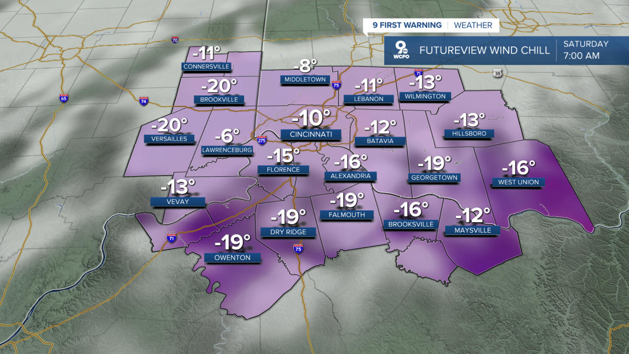
Friday continues the bitter trend, with highs only climbing into the upper teens and overnight lows again near –2°, keeping most of the day firmly below freezing. Saturday gets another shot of Arctic air, with a midday high near 15° and nighttime lows once more dropping toward zero or below. These readings will combine with gusty winds to produce dangerously cold wind chill values that drop to -15° to -20° posing a significant risk of frostbite on exposed skin within minutes if proper precautions aren’t taken.
Starting tomorrow through the weekend , cloud cover will be variable but the overarching theme is frigid air that suppresses any substantial warming, with wind chills regularly far colder than the official air temperatures. Given the sustained cold, residents should limit time outside, dress in multiple insulating layers, and be alert to the hazards posed by such prolonged sub-freezing conditions. Next week, highs rise into the low 30s, while not back to average, so it'll feel more liveable.
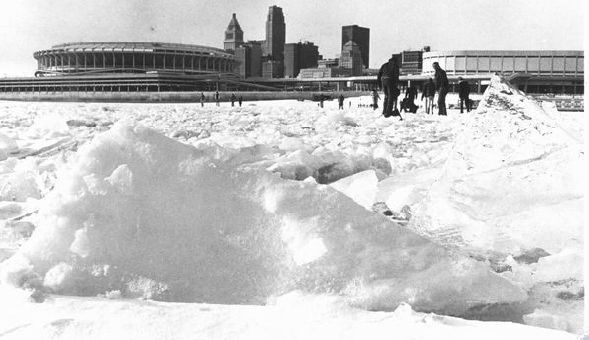
For the Ohio River near Cincinnati, despite the ongoing Arctic cold, it will not completely freeze over this winter. While the river does develop surface ice and floating ice chunks during extended periods of below-freezing temperatures, a full freeze from bank to bank is rare. AS you may know, records show that the Ohio River only froze across its entire width under extremely prolonged and intense cold, such as during the severe winters of 1976–1977 and 1977–1978 when temperatures stayed below freezing for many weeks, allowing ice buildup tens of inches thick in places.
Today, the river’s deeper, managed pools created by locks and dams require much longer periods of sustained cold to cool the entire water column to freezing, and even then most ice forms at the surface. Additionally, industrial and urban heat contributions and steady water movement inhibit complete freeze. Even with current Arctic air, this cold snap isn’t expected to last long enough or reach sufficiently extreme water cooling to freeze the river solid, of course, we have seen localized surface ice and chunks.
TONIGHT
Mostly cloudy
Slight snow chance to the south
Low: 6
FRIDAY
Light snow possible to the south (AM only)
Mostly cloudy
High: 18
FRIDAY NIGHT
Mostly cloudy
Colder
Low: -2
9 First Warning Weather 24/7 Livestream
==========
- Interactive Radar: Track weather to your doorstep
- Sign up for severe weather email alerts
- Check latest school closings and delays
- WCPO traffic updates
- Metro bus detours and updates (or call the hotline at 513-632-7538)
- Latest power outages from Duke Energy
- Flight cancellations and delays from CVG, other U.S. airports
