


Our frigid weather continues into Sunday morning! Temperatures will dip down into the low single digits. Even though the wind will be light, wind chills will start the day around -5.
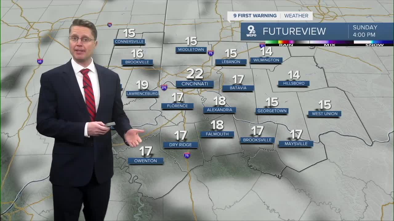
Sunday afternoon brings a little more sunshine and a little more warmth, but highs will still be well below the average of 41 in Cincinnati. Upper teens and low 20s will be common for the afternoon.
If you feel like we've been trapped in this arctic cold for a while, you're right! The second half of January has certainly been one to forget!

Monday starts in the upper single digits as we head back to work and school. The little warm-up continues later in the day with upper 20s, but there won't be as much sunshine.
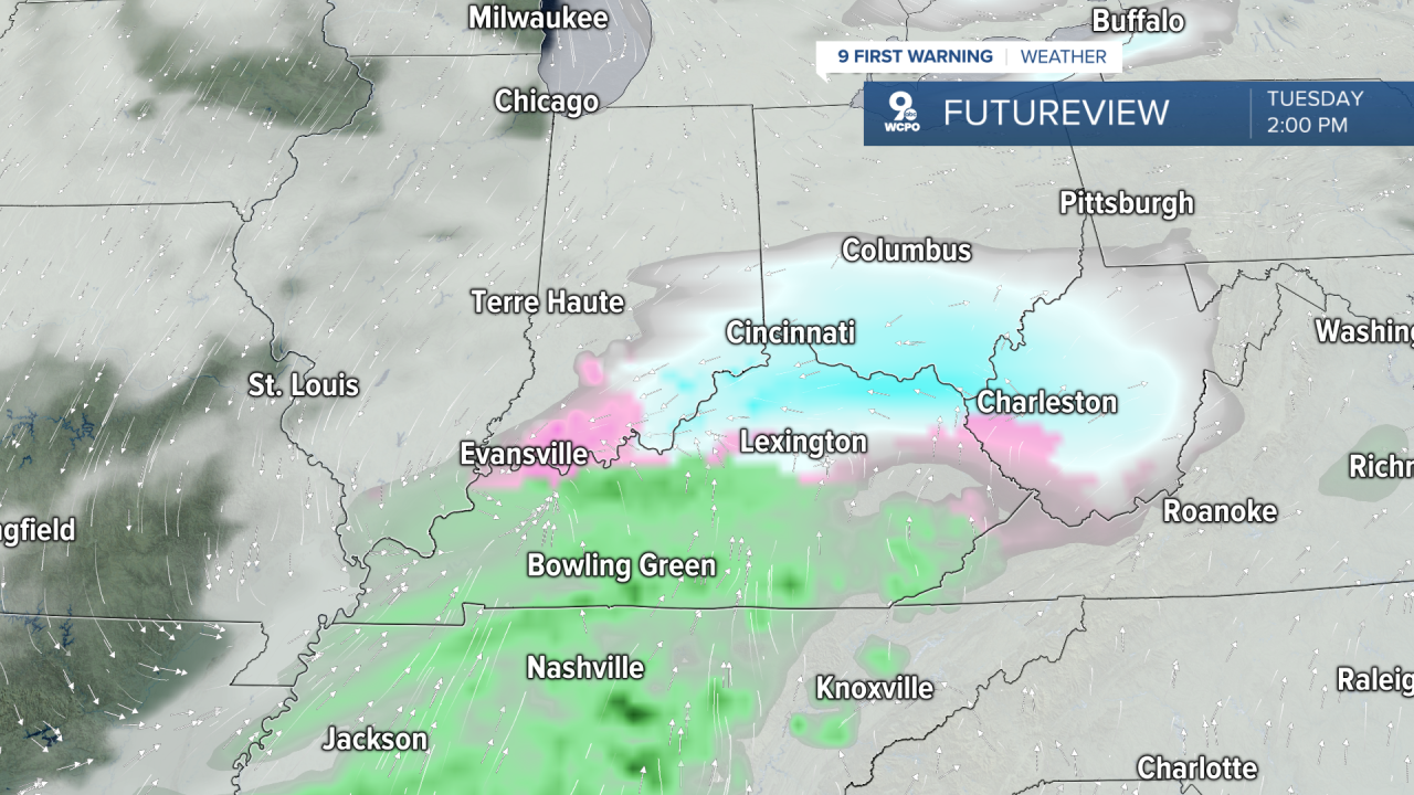
Snow is looking more likely Tuesday morning and afternoon across the region. It's not a huge system, but with an inch or two of snow possible, it could easily add some new slippery areas to your commutes. Highs will be in the low 30s, likely keeping everything as snow.
Then, another shot of colder air moves in, dropping us back down into the mid and upper 20s for Wednesday and Thursday.
Friday brings a one-day warm-up into the mid 30s along with a slim chance for snow.
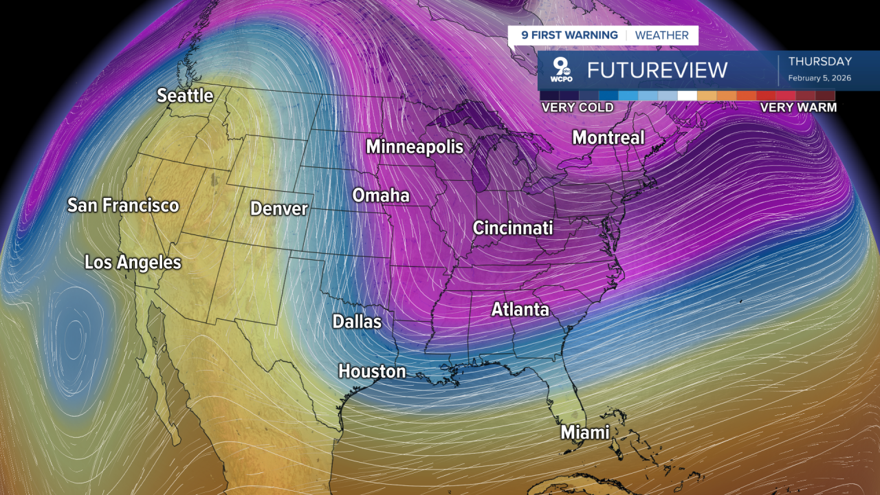
We drop back down into the upper 20s for the weekend as another shot of arctic air moves into the Midwest.
OVERNIGHT
Mostly cloudy
Frigid
Low: 2
SUNDAY
Mostly sunny
Not as cold
High: 22
SUNDAY NIGHT
Partly cloudy
Very cold
Low: 8
MONDAY
Mostly cloudy
Warmer
High: 29
9 First Warning Weather 24/7 Livestream
==========
- Interactive Radar: Track weather to your doorstep
- Sign up for severe weather email alerts
- Check latest school closings and delays
- WCPO traffic updates
- Metro bus detours and updates (or call the hotline at 513-632-7538)
- Latest power outages from Duke Energy
- Flight cancellations and delays from CVG, other U.S. airports
