


We get cold again overnight, dropping down into the low and mid 20s for Sunday morning. Most of the morning will be in the 20s, so grab the winter gear for any Bengals tailgates.
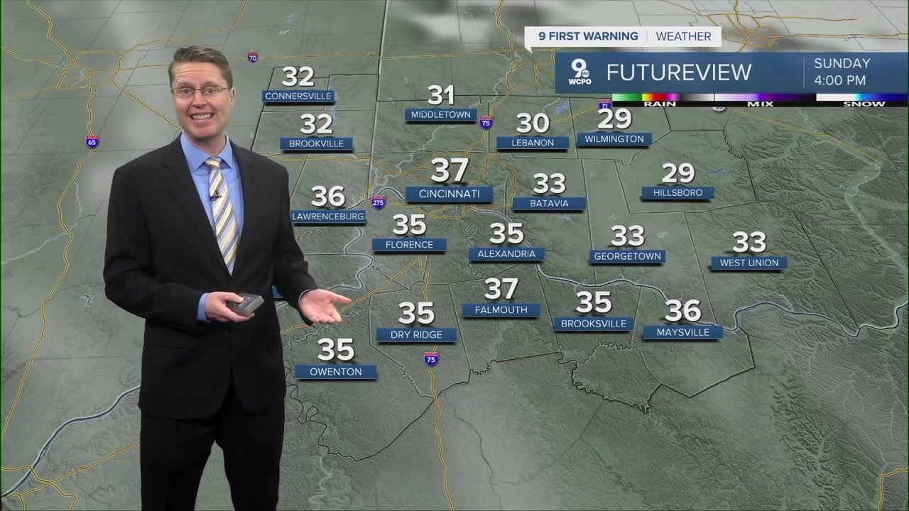
Sunday afternoon will be mostly sunny and a touch warmer. After the Bengals kick off in the low 30s at 1pm, temperatures top out in the upper 30s later in the afternoon.

A nice warm-up gets underway for the workweek, pushing temperatures above average. Monday will be mostly sunny with upper 40s.
Tuesday we push about 15 degrees above average with mid 50s, but we turn mostly cloudy. Late in the day, a weak cold front will trigger a few spotty and light showers in the Tri-State, but the rain won't be for everyone.

Wednesday looks mostly cloudy with mid 50s.
A better chance for rain arrives Thursday and continue at times into Friday. The two wettest days coming up will also be the warmest days with upper 50s.
Cooler air starts to move back in next weekend. Saturday will be in the upper 40s. A few raindrops or snowflakes are possible. Then, we drop into the upper 30s for Sunday.
OVERNIGHT
Partly cloudy
Colder
Low: 23
SUNDAY
Mostly sunny
Nice
High: 37
SUNDAY NIGHT
Partly cloudy
Cold
Low: 26
MONDAY
Mostly sunny
Warmer
High: 48
TUESDAY
Mostly cloudy
Spotty light rain
High: 55
9 First Warning Weather 24/7 Livestream
==========
- Interactive Radar: Track weather to your doorstep
- Sign up for severe weather email alerts
- Check latest school closings and delays
- WCPO traffic updates
- Metro bus detours and updates (or call the hotline at 513-632-7538)
- Latest power outages from Duke Energy
- Flight cancellations and delays from CVG, other U.S. airports
