


Our frigid weather continues into the Monday morning commute as many of us dip down into the upper single digits across the Tri-State. The wind will be light, but wind chills could still briefly drop below zero. Make sure the kids are bundled up in layers and have on their hat, gloves, and scarf.
Monday will be mostly cloudy with a few pockets of snow across the region. Even if you see some of the snow, it shouldn't cause any new issues. Our little warm-up continues into the low 30s for the afternoon. This will be Cincinnati's first time in the 30s in about a week and a half. While this will feel better, it is still 10 degrees below average.
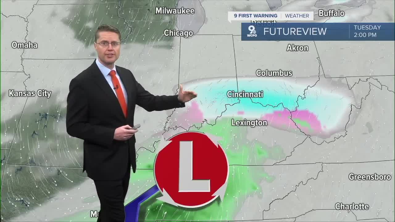
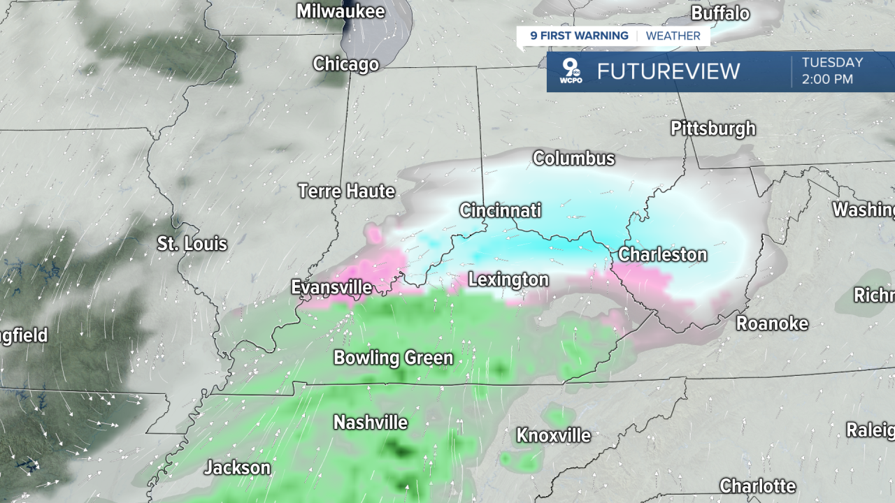
An area of low pressure arrives from the west Tuesday, which will likely start to produce some snow by late Tuesday morning. It's not a huge system, but it's looking more likely it will cut through at least part of the Tri-State. The snow will pick up late morning and into the afternoon, ending Tuesday night. This will probably give some of us a new one to two inches of snow, adding some new slippery areas for the drive home. Highs will be near freezing, so anything that sticks will be a little easier for road crews to melt.
We drop back down into the mid and upper 20s Wednesday and Thursday with mostly cloudy skies both days.
Friday brings a one-day warm-up into the mid 30s along with a slim chance for snow.
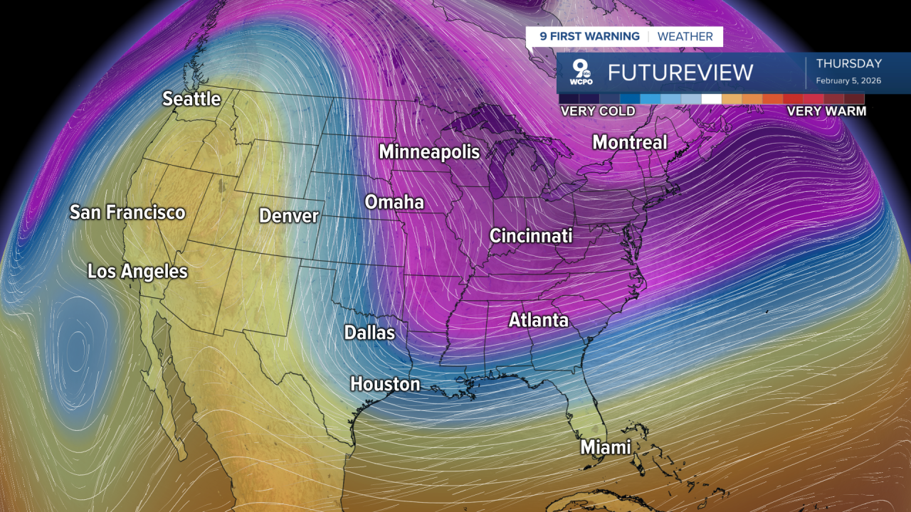
We drop back down into the 20s for the weekend as another shot of arctic air moves across the Midwest.
It will start to warm back up again early in the next week, and there are signs we could get closer to average in the middle of the week.
OVERNIGHT
Mostly clear
Very cold
Low: 8
MONDAY
Mostly cloudy
Spotty snow
High: 31
MONDAY NIGHT
Mostly cloudy
Not as frigid
Low: 22
TUESDAY
Mostly cloudy
Snow likely
High: 33
9 First Warning Weather 24/7 Livestream
==========
- Interactive Radar: Track weather to your doorstep
- Sign up for severe weather email alerts
- Check latest school closings and delays
- WCPO traffic updates
- Metro bus detours and updates (or call the hotline at 513-632-7538)
- Latest power outages from Duke Energy
- Flight cancellations and delays from CVG, other U.S. airports
