


The cold front and the scattered rain it brought with it will be gone by the time most of us wake up Sunday morning. We'll drop down into the low and mid 30s for Sunday morning.
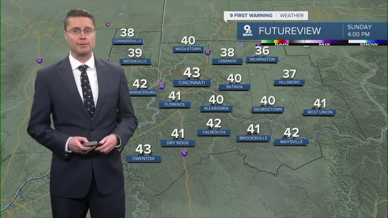
Sunday starts with a lot of clouds, but we should see at least some sunshine in the second half of the day. It will be a lot colder behind the cold front with highs in the low 40s. That's about 20 degrees colder than Saturday.
Overnight and into Monday morning, an area of snow could travel just enough north to clip the Tri-State. Even if the snow reaches us, any accumulations should stay under an inch, but the timing of the snow could make for a few slick spots during the morning commute. By late morning, we get warm enough to change any leftover snow into light rain. The afternoon will be drier with low 40s.
A warm front arrives Tuesday, kicking off scattered rain throughout the day, but it also warms us up. Highs will be in the upper 50s.

A cold front will follow at some point Wednesday, bringing another round of rain... but it doesn't drop temperatures. Highs will be in the mid 60s.
Thursday will also be in the mid 60s with yet another round of rain.
In fact, another system brings more rain Friday and Saturday, but we continue to warm into the 60s both afternoons.
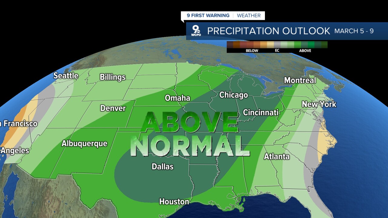
The precipitation outlook is trending wetter with above-average rainfall expected through the next two weeks.
OVERNIGHT
Mostly cloudy
Scattered rain
Low: 34
SUNDAY
Slow clearing
Colder
High: 43
SUNDAY NIGHT
Mostly cloudy
Rain & snow
High: 28
MONDAY
Mostly cloudy
Wintry mix
High: 42
9 First Warning Weather 24/7 Livestream
==========
- Interactive Radar: Track weather to your doorstep
- Sign up for severe weather email alerts
- Check latest school closings and delays
- WCPO traffic updates
- Metro bus detours and updates (or call the hotline at 513-632-7538)
- Latest power outages from Duke Energy
- Flight cancellations and delays from CVG, other U.S. airports
