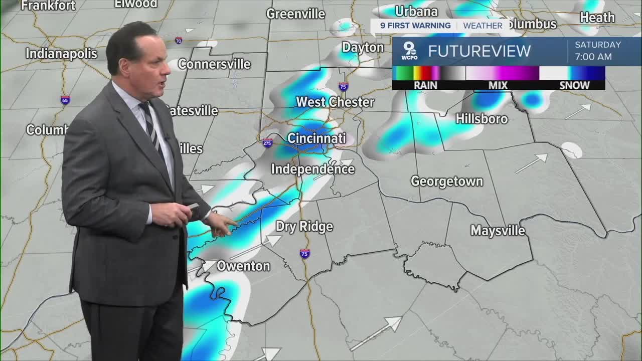


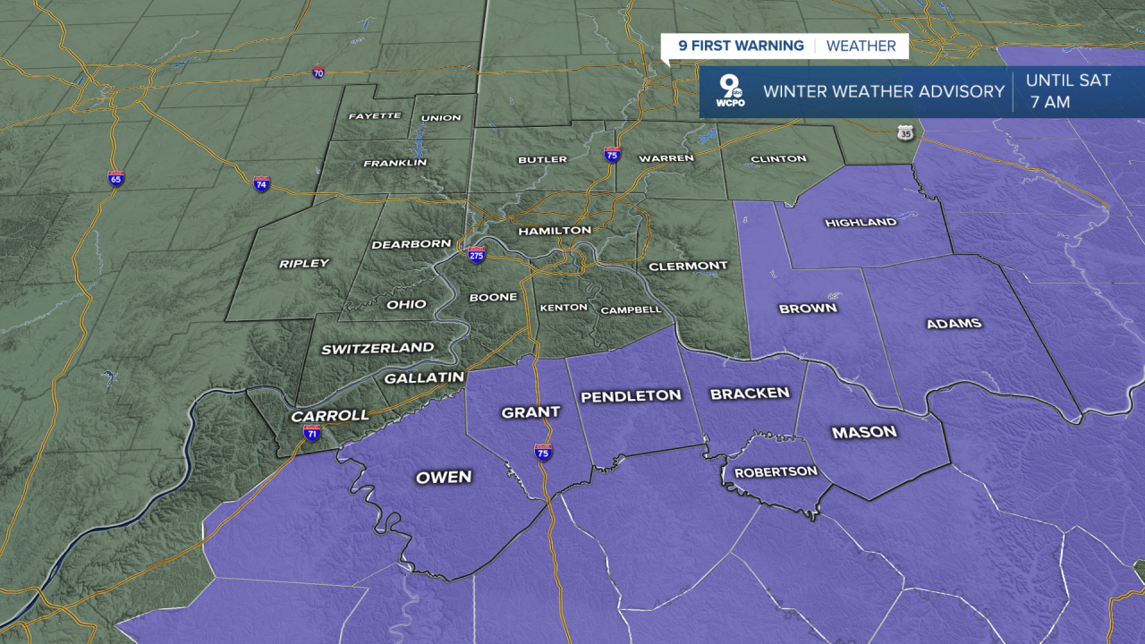
The wet snow continues and will shut down shortly, if it hasn't already. The greatest amounts will be east of I-71, where 1"-3" of snow is possible. A WINTER WEATHER ADVISORY has been issued, and you can see it below. For many, this will be a "wet" snow, and while it may not accumulate, there is a risk for slick roads as the temperatures drop significantly below freezing by morning. Watch out for black ice.
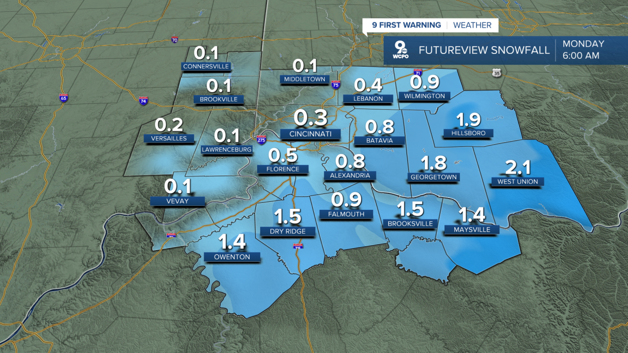
For a number of communities, the snow will not be a big deal. But you can see from the snowfall totals that some areas will find travel difficult in the morning.
At the moment, our computer models are showing some snow showers that could bring a quick 1/2" of snow to isolated locations in the morning. Otherwise, we are looking at flurries and highs in the low 30s.

Then, the arctic air invades the Tri-State, and we'll stay below the freezing mark until midday Wednesday. But it isn't just the temperature, it's the wind chill. Wind chills will be in the 0-10 degree range over this span of time as well during the morning hours, with a feels-like temperature of teens during the day!
OVERNIGHT
Snow ends
A few slick spots
Low: 30
SATURDAY
Isolated snowshowers
Mostly cloudy
High: 32
SATURDAY NIGHT
Partly cloudy
Colder
Low: 13
SUNDAY
Partly cloudy
Wind Chills single digits, teens all day
High: 24
9 First Warning Weather 24/7 Livestream
==========
- Interactive Radar: Track weather to your doorstep
- Sign up for severe weather email alerts
- Check latest school closings and delays
- WCPO traffic updates
- Metro bus detours and updates (or call the hotline at 513-632-7538)
- Latest power outages from Duke Energy
- Flight cancellations and delays from CVG, other U.S. airports
