


9 First Warning Alert Day through Monday morning due to snow impacts.
Around 8pm Sunday we started to see snow coming down for most of the area but accumulations have been limited to grassy surfaces and elevated surfaces. Overnight there isn't much to be worried about. That will change slightly as we prepare for the Monday morning commute.
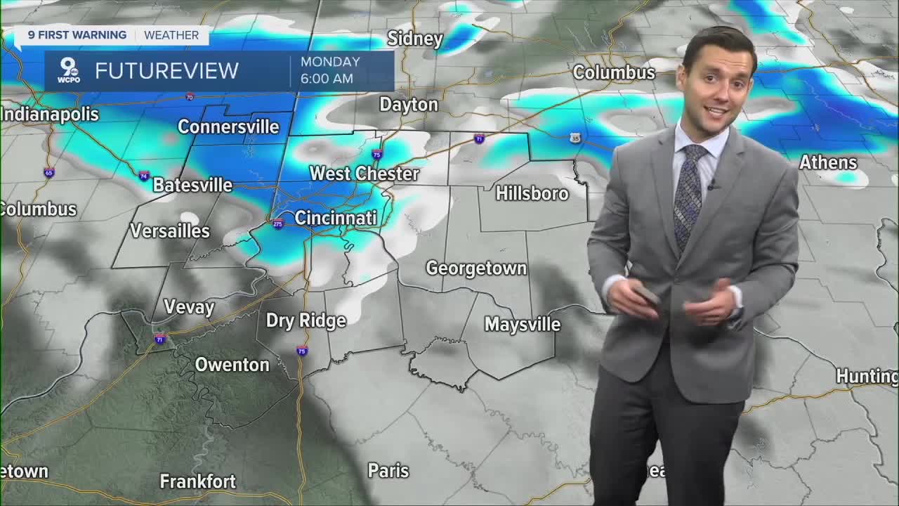
As of right now, 6-10am looks to be when most of the snow is going to fall arond the area. At times snow will be coming down at a good clip for some and visibilty will be low on the roads. We aren't expecting much, if any, accumulation on the roads, but it will certainly be wet and slick.

Another big factor is the temperatures. Air temps dip to the mid 20s for everyone and wind chills will be in the teens.

Some areas could pick up to an inch or so on cars or grassy surfaces. The timing of the snow at rush hour could cause some travel issues due to reduced visibility. Roads should remain relatively warm, limiting any significant problems for drivers.
A slight chance for rain or snow returns Tuesday afternoon with another weak wave of energy, but amounts look light.
TONIGHT
Cold
Snow
Low: 26
MONDAY
Scattered snow
Blustery
High: 37
MONDAY NIGHT
Snow tapers off
Slick spots
Low: 24
9 First Warning Weather 24/7 Livestream
==========
- Interactive Radar: Track weather to your doorstep
- Sign up for severe weather email alerts
- Check latest school closings and delays
- WCPO traffic updates
- Metro bus detours and updates (or call the hotline at 513-632-7538)
- Latest power outages from Duke Energy
- Flight cancellations and delays from CVG, other U.S. airports
