


It was a hot one today. We topped out at 82°. More than 15° above average..
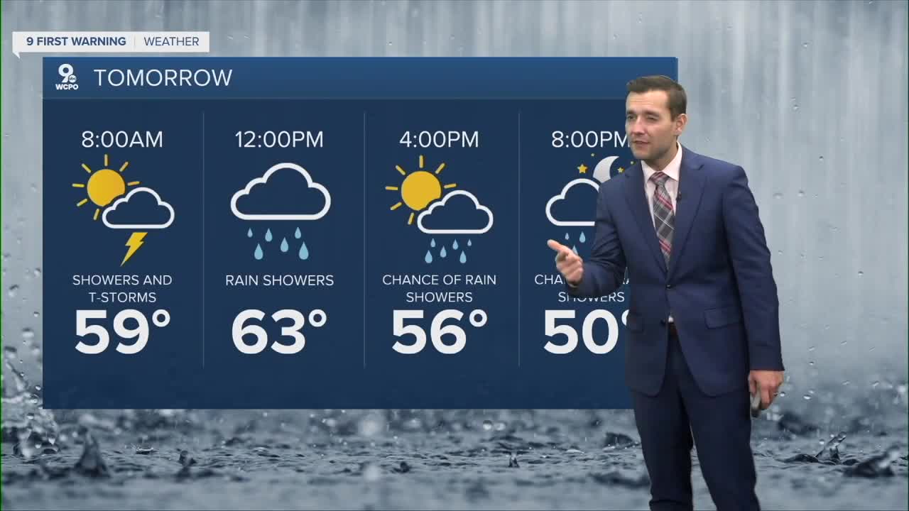
As we move into the overnight hours winds will start to pick up. While we can't rule out a few showers late tonight, he bulk of the rain and especially storms ramp up early Sunday morning.

A few storms could be on the stronger side, with gusty winds as the main concern. The Storm Prediction Center has our area under a marginal risk for severe weather, which means an isolated strong storm is possible.

Right now it looks like the strongest storms with a severe threat move through the tri-state from 7-10am. It will be gusty from sun up to sun down with gusts, even without storms, topping out around 30mph. A few spotty showers could linger into the afternoon, keeping things cool and unsettled.
TONIGHT
Heavy rain
Isolated storms, possibly severe
Low: 66
SUNDAY
Showers & storms early
Turning cooler & windy
High: 66
SUNDAY NIGHT
Showers & storms early
Turning cooler & windy
Low: 42
9 First Warning Weather 24/7 Livestream
==========
- Interactive Radar: Track weather to your doorstep
- Sign up for severe weather email alerts
- Check latest school closings and delays
- WCPO traffic updates
- Metro bus detours and updates (or call the hotline at 513-632-7538)
- Latest power outages from Duke Energy
- Flight cancellations and delays from CVG, other U.S. airports
