

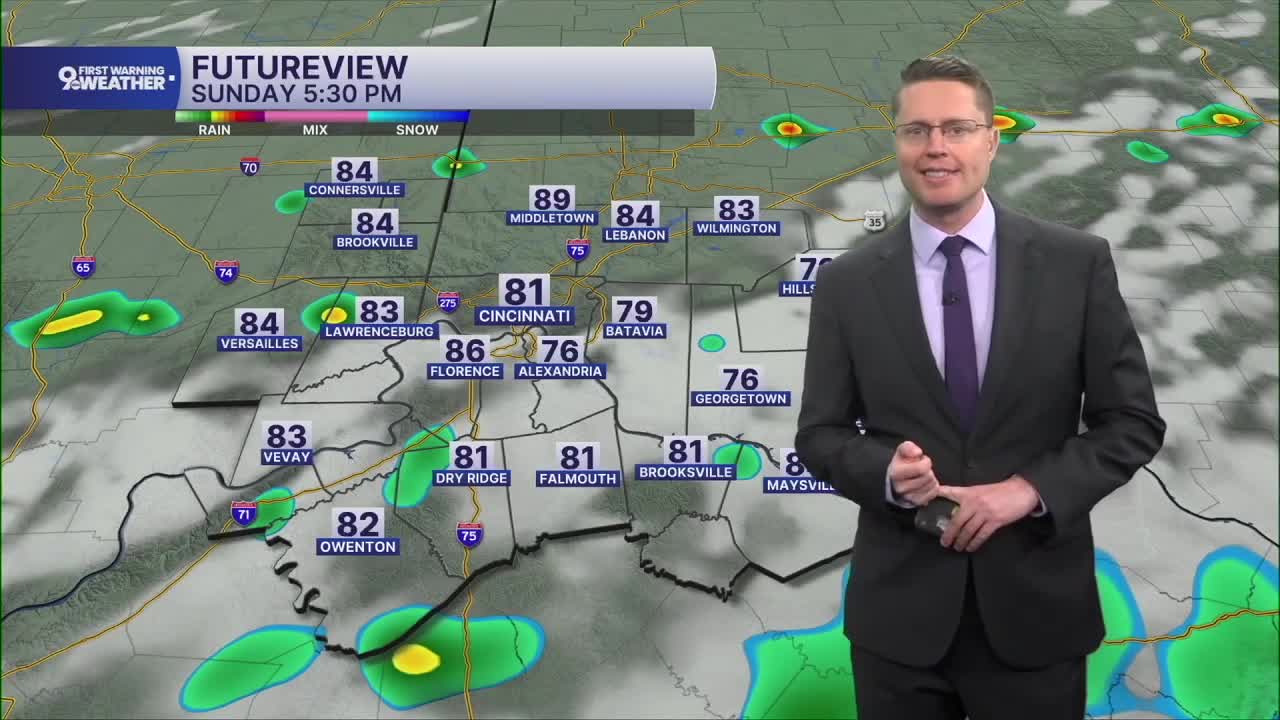



After a stormy Saturday, the weather stays much more quiet overnight. It will be mostly cloudy as we cool off into the upper 60s for Sunday morning.
Sunday afternoon will be partly cloudy with low 80s. A few spotty showers will pop up in the second half of the day, but a majority of the region stays dry.
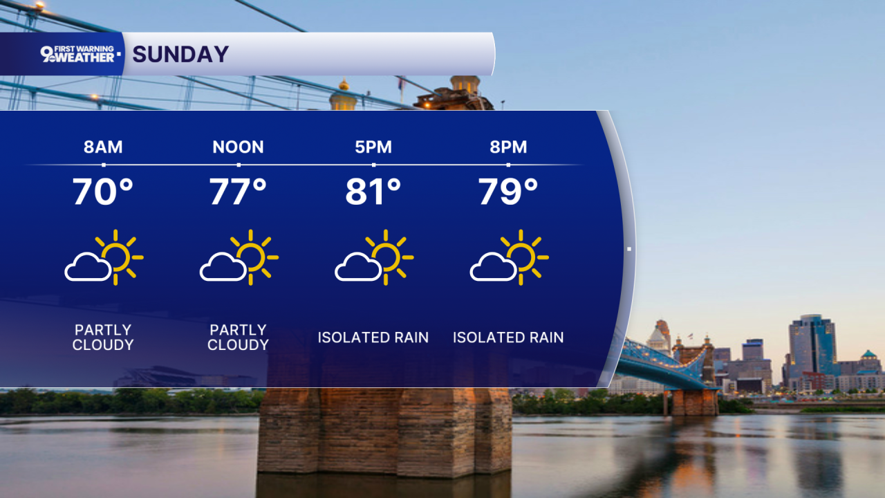
We'll spend the first half of the workweek heating up. Monday will be in the mid 80s with a mix of sunshine and clouds.
The sunshine will be in control Tuesday, helping to push us into the upper 80s. We stay mostly sunny Wednesday as Cincinnati makes a run for 90 degrees.
We'll stay humid the entire workweek, pushing the heat index near 100 in the second half of the week.
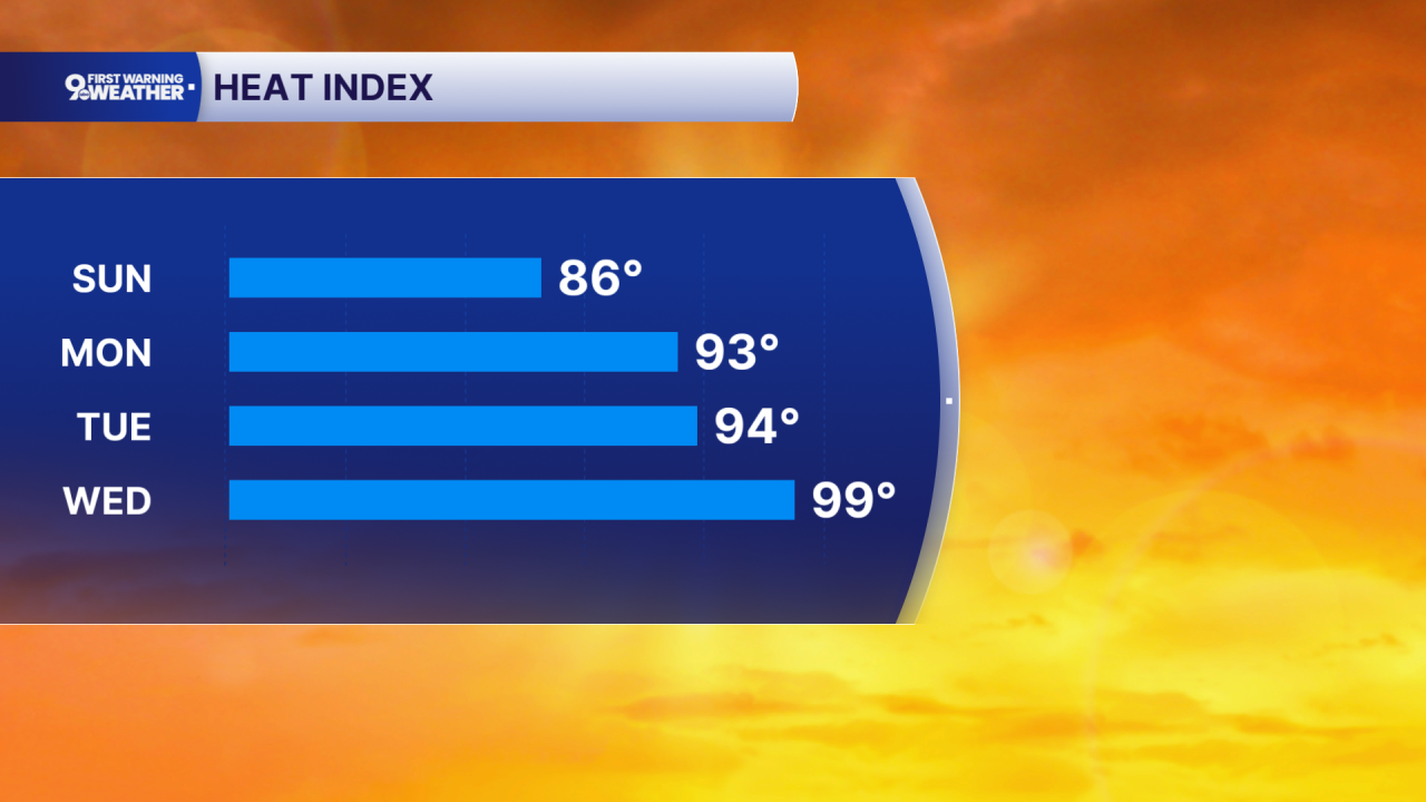
Temperatures continue to top out around 90 Thursday and Friday. Most of us will be dry, but a few spotty showers could pop up Thursday.
A small chance for rain returns Saturday, but there's a better chance for scattered showers and storms to hit your backyard next Sunday and Monday.
OVERNIGHT
Mostly cloudy
Spotty rain
Low: 68
SUNDAY
Partly cloudy
Isolated rain
High: 86
SUNDAY NIGHT
Partly cloudy
Cooler
Low: 66
MONDAY
Partly cloudy
Humid
High: 86
9 First Warning Weather 24/7 Livestream
==========
- Interactive Radar: Track weather to your doorstep
- Sign up for severe weather email alerts
- Check latest school closings and delays
- WCPO traffic updates
- Metro bus detours and updates (or call the hotline at 513-632-7538)
- Latest power outages from Duke Energy
- Flight cancellations and delays from CVG, other U.S. airports
