


Happy Fourth of July!
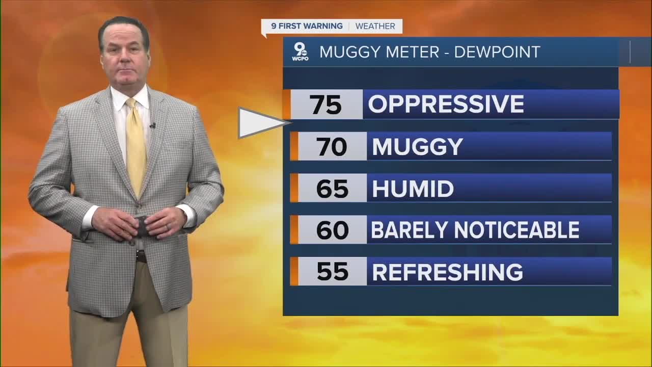
The forecast is exactly what you'd imagine it would be at this time of the year...hot and humid!
Each day, the conditions will get hotter, peaking on Sunday for this mini heatwave. Friday starts will highs in the low 90s, and the humidity climbs enough where the heat index will reach the mid 90s.
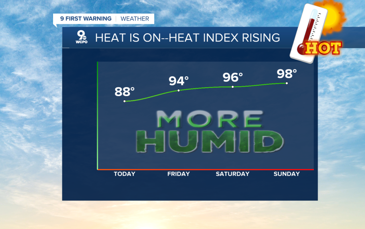
More heat and humidity send the thermometer into the low 90s for the weekend as the heat index hits the upper 90s by Sunday.
High pressure situated over the Carolinas is rotating this moisture into the Tri-State, but it's also keeping the area dry.
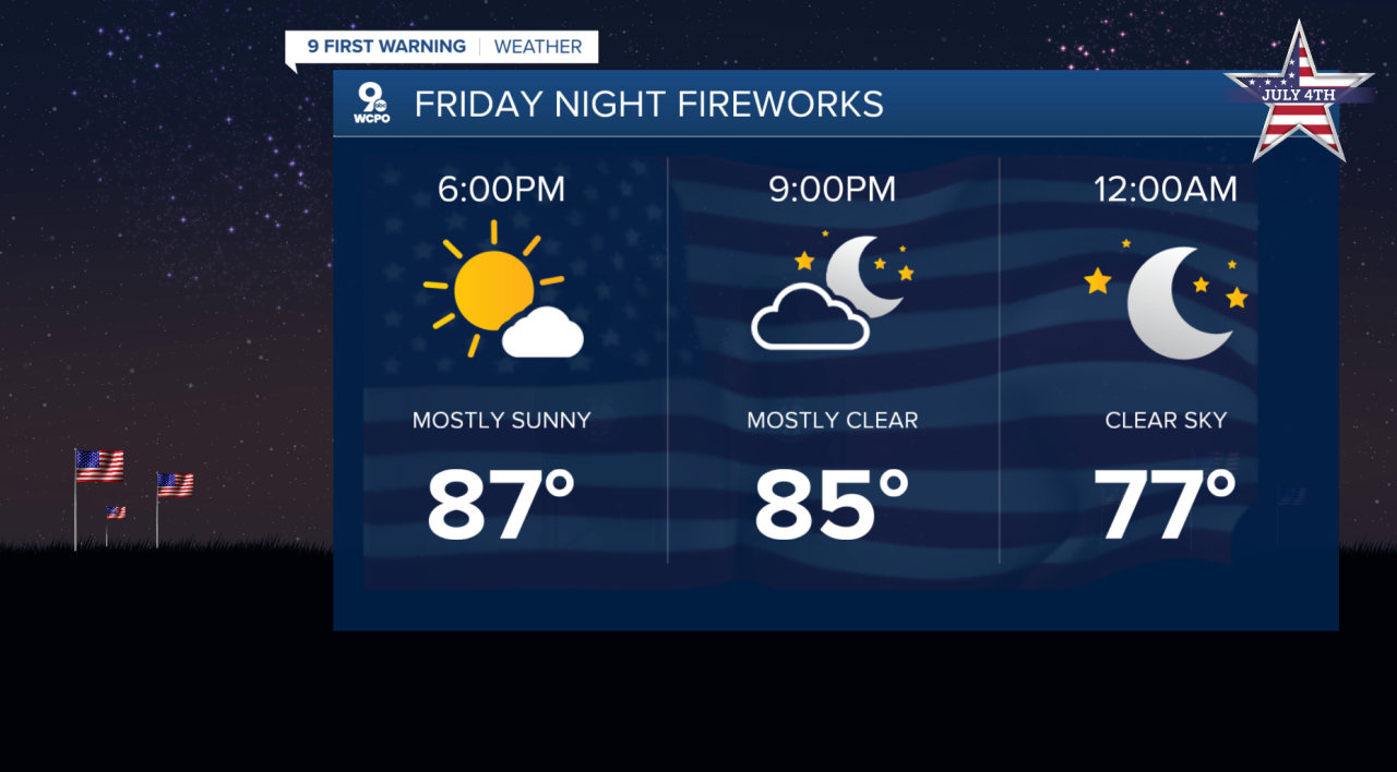
This means the fireworks forecast for tonight and tomorrow will be fine, but humid with temps near 80 tonight and in the mid-80s tomorrow.
OverNIGHT
Mostly clear
Mild
Low: 68
FRIDAY
Sunny & Humid
High: 91
FRIDAY NIGHT
Mostly clear
Mild
Low: 68
9 First Warning Weather 24/7 Livestream
==========
- Interactive Radar: Track weather to your doorstep
- Sign up for severe weather email alerts
- Check latest school closings and delays
- WCPO traffic updates
- Metro bus detours and updates (or call the hotline at 513-632-7538)
- Latest power outages from Duke Energy
- Flight cancellations and delays from CVG, other U.S. airports
