


We stay mostly cloudy overnight, helping to keep us a bit warmer compared to recent mornings. We only drop down into the low 30s to start Wednesday.
After a cloudy start to the day, we will start to see a little more sunshine Wednesday afternoon. Our warm-up continues with mid 40s, getting us back to average for the middle of December.

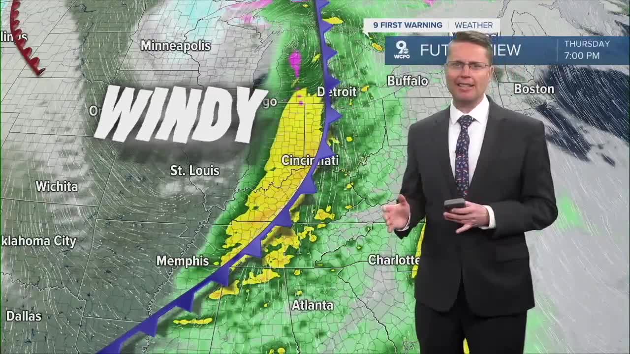
It looks like most of the Tri-State will be dry heading into work and school Thursday, but a couple spotty light showers could be out there in the morning. As the wind picks up out of the south ahead of our next cold front, temperatures will climb into the low 50s. Rain, and a few rumbles of thunder, will be a lot more likely in the second half of the day. We can't rule out a stronger storm or two south of Greater Cincinnati with strong wind, but the overall severe weather threat is low.
The cold front will arrive Thursday night, and if the cold air blows in quickly enough, we could see the last little bit of rain Thursday night change into snow, but it shouldn't stick to the ground or cause any problems.

It will stay windy Friday as colder weather keeps blowing in. We will only make it into the low 30s in the afternoon with a mix of sun and clouds.
Looking ahead to the weekend, temperatures warm back closer to average. Saturday will be a little windy early on with highs in the upper 40s. Sunday will be a touch cooler with low 40s, but the wind should be lighter.

Monday will be in the mid 40s with some sunshine.
Rain looks a little more likely Tuesday with highs in the mid 40s.
A few pockets of light rain could stay with us for Christmas Eve and Christmas Day on Wednesday and Thursday, but we get a little warmer. Wednesday will be in the upper 40s, followed by low 50s for Christmas.
OVERNIGHT
Mostly cloudy
Chilly
Low: 32
WEDNESDAY
Partly sunny
Near average
High: 44
WEDNESDAY NIGHT
Partly cloudy
Chilly
Low: 33
THURSDAY
Cloudy
Rain likely
Windy
High: 52
9 First Warning Weather 24/7 Livestream
==========
- Interactive Radar: Track weather to your doorstep
- Sign up for severe weather email alerts
- Check latest school closings and delays
- WCPO traffic updates
- Metro bus detours and updates (or call the hotline at 513-632-7538)
- Latest power outages from Duke Energy
- Flight cancellations and delays from CVG, other U.S. airports
