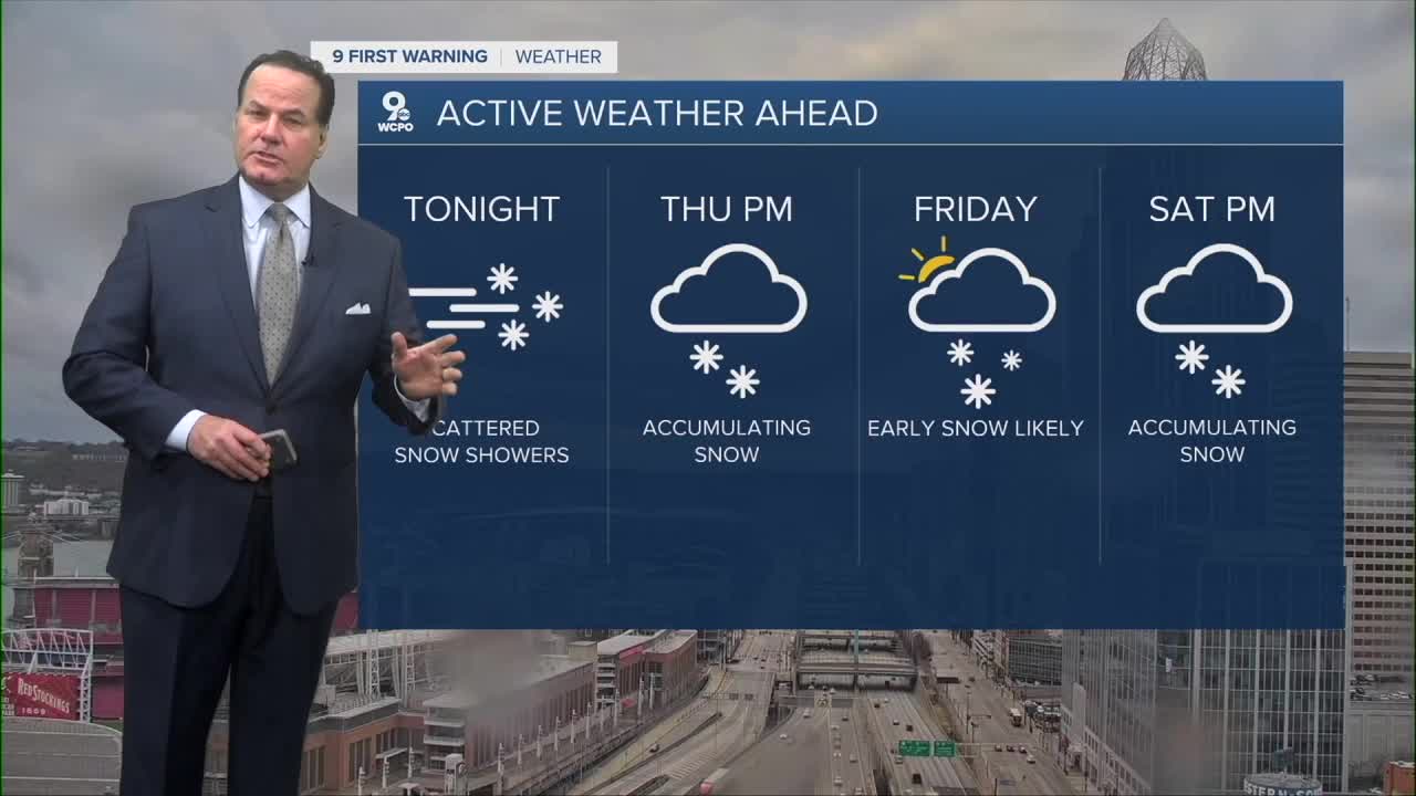


Snow showers continue tonight with temperatures cooling into the mid-20s.
We'll see dry conditions on Thursday under mostly cloudy skies and cold highs just above freezing.
A Winter Weather Advisory has been issued for Thursday night, starting at 7 p.m. and continuing until Friday at 10 a.m. as we are set for accumulating snow.

Our 9 First Warning Weather Alert Day begins Thursday evening through early Friday due to that snow. We should start to see the snow fly by around 9 p.m. Expect widespread snow overnight, which will impact the Tri-State, with likely school closures and travel issues. We are looking at 2-4" of snowfall for most locations by Friday morning.

Friday afternoon, a few flurries or even a snow shower could be leftover as highs creep to around freezing. But generally dry conditions last until Saturday afternoon.
Another clipper system is set to move through Saturday mid-afternoon with light accumulations. Clipper systems are normally on the lighter side with 1-2" of snowfall.
Arctic air settles in this weekend with highs in the teens and single digits. The Bengals game will be brutal.

TONIGHT
Isolated snow showers
Flurries
Low: 26
THURSDAY
Mostly cloudy
High: 33
THURSDAY NIGHT
Snow develops
2-4" of snow for most
Low: 25
9 First Warning Weather 24/7 Livestream
==========
- Interactive Radar: Track weather to your doorstep
- Sign up for severe weather email alerts
- Check latest school closings and delays
- WCPO traffic updates
- Metro bus detours and updates (or call the hotline at 513-632-7538)
- Latest power outages from Duke Energy
- Flight cancellations and delays from CVG, other U.S. airports
