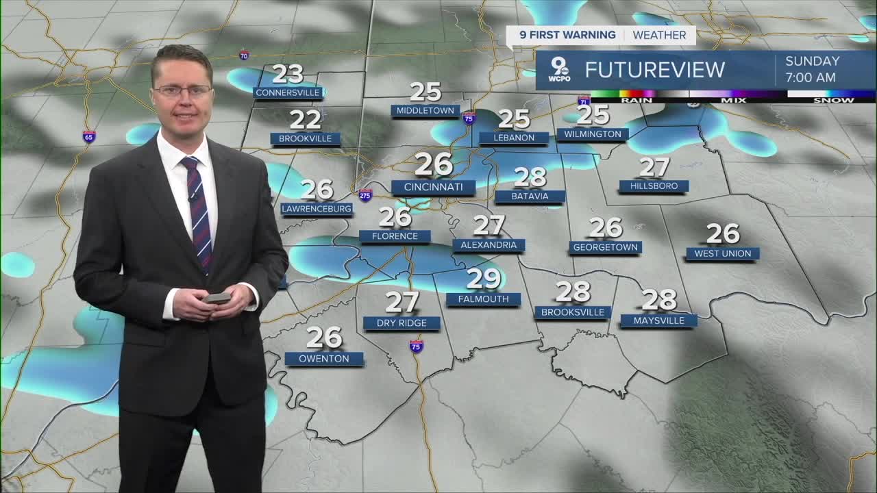


After midnight, scattered snow will move into the Tri-State which continues into Sunday morning. Any pocket of snow could reduce visibility for drivers and could make for a few slippery spots. The bulk of the snow should end by late Sunday morning with any accumulation under an inch.
Sunday will also be colder and breezy. We start the day in the mid 20s and only warm just above freezing in the afternoon. Wind chills likely only reach the low to mid 20s.

Skies begin to clear into Monday morning, meaning more sunshine to start the workweek, but it will be cold in the morning with low 20s. The afternoon warms into the low 40s, which will be an improvement from the late weekend.
Tuesday will be mostly cloudy, but the warm-up continues into the upper 40s.
Another weak cold front arrives Wednesday morning, bringing light rain at times throughout the day. Highs will be in the low 40s. As temperatures fall Wednesday night, the rain likely changes into some light snow, which should end Thursday morning. Right now, it doesn't look like there will be any significant accumulation.

Thursday afternoon will be mostly cloudy and colder with low 30s.
We rebound into the upper 30s Friday with a lot of clouds.
Some light rain and snow are possible on Saturday, and then we get colder early next week.
OVERNIGHT
Cloudy
Scattered snow
Low: 26
SUNDAY
Mostly cloudy
Morning scattered snow
Windy
High: 33
SUNDAY NIGHT
Clearing skies
Cold
Low: 23
MONDAY
Mostly sunny
Warmer
High: 41
9 First Warning Weather 24/7 Livestream
==========
- Interactive Radar: Track weather to your doorstep
- Sign up for severe weather email alerts
- Check latest school closings and delays
- WCPO traffic updates
- Metro bus detours and updates (or call the hotline at 513-632-7538)
- Latest power outages from Duke Energy
- Flight cancellations and delays from CVG, other U.S. airports
