


Another incredibly beautiful day around the Tri-State, with highs reaching the mid-to-upper 70s. Now, we're set for more nice weather, but it will be warmer as temperatures climb each day over the weekend.
In the meantime, we'll see a clear sky with morning lows in the mid-50s. But there's much "colder" air to come this next week.

As for the Labor Day weekend, it just couldn't be better. I can't remember a fireworks weekend that will feel this good. Temperatures will be climbing every day through Monday, but by only a couple of degrees. I will say by Monday it'll feel a little more usual for this time of year. The seasonal average is 84 degrees.

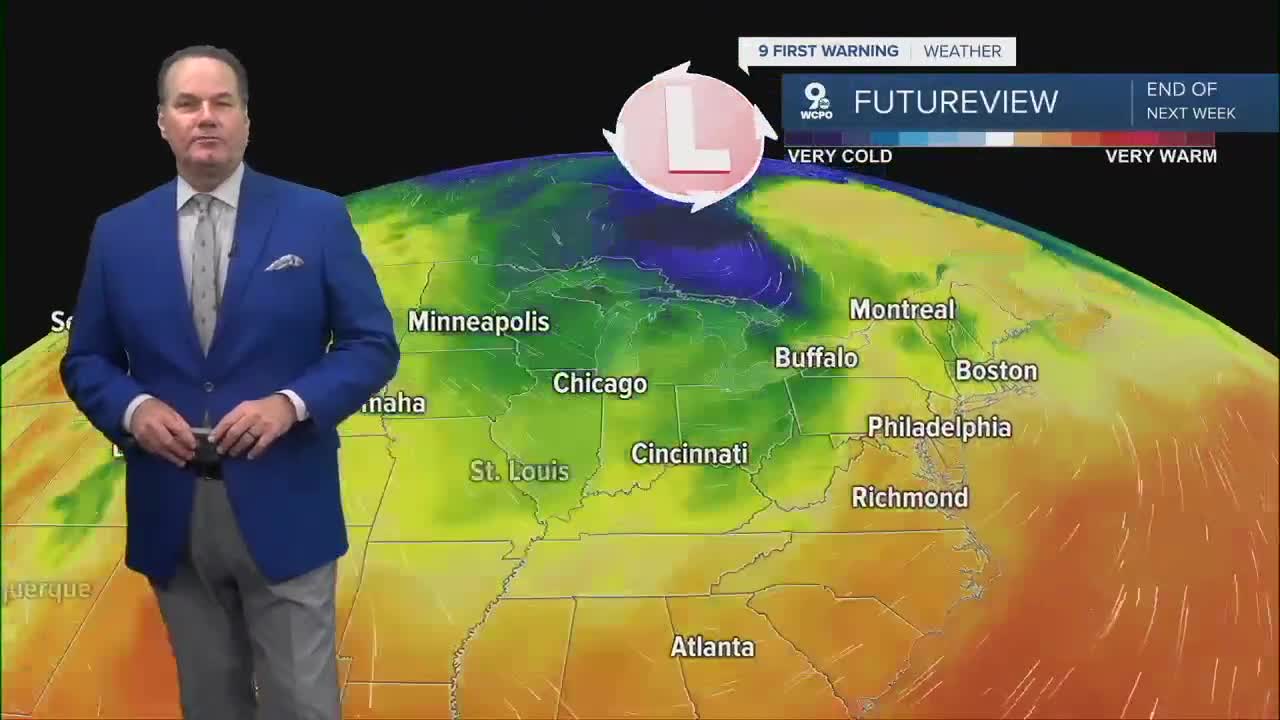
The next chance for wet weather will be Tuesday into Wednesday. It looks like widespread rain with a chance for a storm or two. More importantly, this front will originate from the top of the globe. So, we are talking about an arctic front that will unleash cold air across the Tri-State.
By Thursday, afternoon highs may only reach the mid to upper 60s! Morning lows could fall to the low 40s for some communities. What happened to summer ;)
OVERNIGHT
Mostly clear
Cooler
Low: 54
SATURDAY
Mostly sunny
Pleasant
High: 77
SATURDAY NIGHT
Mostly clear
Cool
Low: 54
9 First Warning Weather 24/7 Livestream
==========
- Interactive Radar: Track weather to your doorstep
- Sign up for severe weather email alerts
- Check latest school closings and delays
- WCPO traffic updates
- Metro bus detours and updates (or call the hotline at 513-632-7538)
- Latest power outages from Duke Energy
- Flight cancellations and delays from CVG, other U.S. airports
