


Warmer air is officially moving into the Tri-State, and we could be looking at record-breaking warmth for Reds Opening Day!
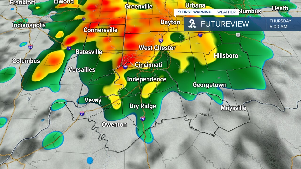
Scattered showers and storms will develop overnight, mainly between 3 a.m. and 9 a.m. This will bring downpours at times. The rain and clouds keep us from cooling off much overnight. The morning will be in the mid 50s.
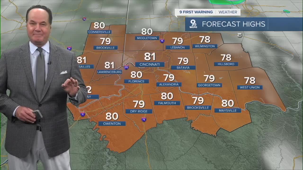
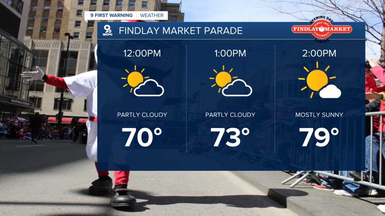
The morning showers wrap up late morning, and we start to see more sunshine midday. By noon, temperatures will be at 70 degrees for the start of the parade. By 4 p.m., when the game begins, temperatures will be in the low 80s! The record high for Thursday is 82 degrees, set back in 1907.
We should get through the ballgame without rain. Clouds will start to increase as we get to sunset.
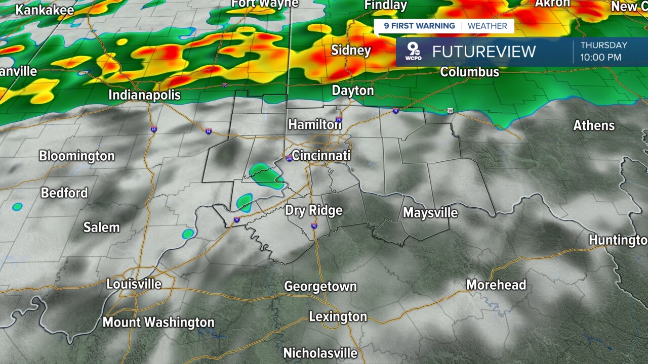
A cold front moves in from the north late Thursday night, bringing a line of showers and storms. These keep looking later and later, likely not getting to areas north of Greater Cincinnati until closer to midnight now. They may not get to Cincy until 3 a.m., followed by some leftover heavier rain in northern Kentucky into Friday morning.
The later timing of the storms is lowering our severe weather threat, but there is still a small chance for a severe storm or two to mix in, especially north. The main concern will be for damaging wind, but a couple of pockets of hail or a short-lived tornado can't be ruled out.
The latest outlook from the Storm Prediction Center has a "slight risk" for severe storms in our very northern locations, with a "marginal risk" for most.
Colder weather moves in behind the cold front for Friday. Temperatures will only be in the upper 40s in the afternoon with a mix of sun and clouds.
Saturday will be mostly sunny with low 50s, followed by a few clouds and a high near 60 on Sunday.
After starting the workweek in the 60s, we warm into the 70s midweek, but there is also a small chance for rain each day in the first half of the workweek.
OVERNIGHT
Mostly cloudy
Showers and storms overnight
into the morning
Low: 56
THURSDAY
Morning Rain
Then Sunshine and warm
High: 81
THURSDAY NIGHT
Rain and storms develop
Severe storms possible
Low: 44
9 First Warning Weather 24/7 Livestream
==========
- Interactive Radar: Track weather to your doorstep
- Sign up for severe weather email alerts
- Check latest school closings and delays
- WCPO traffic updates
- Metro bus detours and updates (or call the hotline at 513-632-7538)
- Latest power outages from Duke Energy
- Flight cancellations and delays from CVG, other U.S. airports
