


We get another great forecast today!
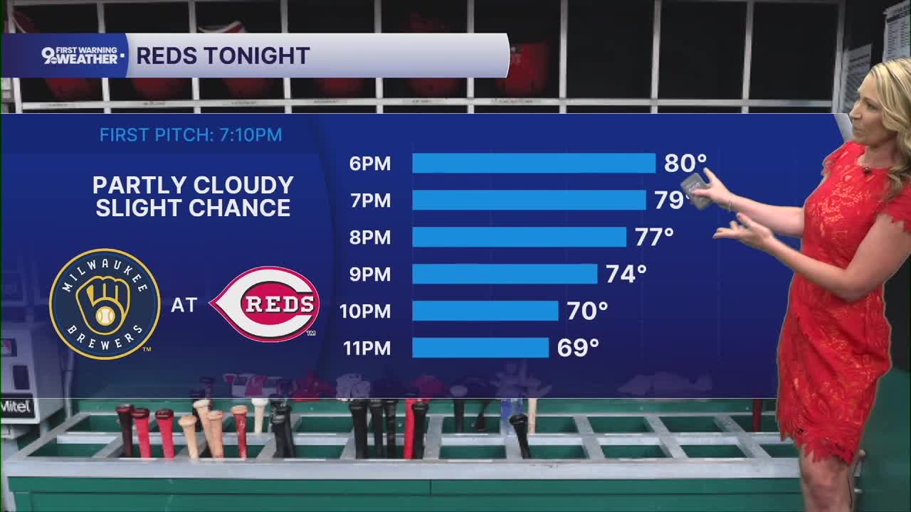
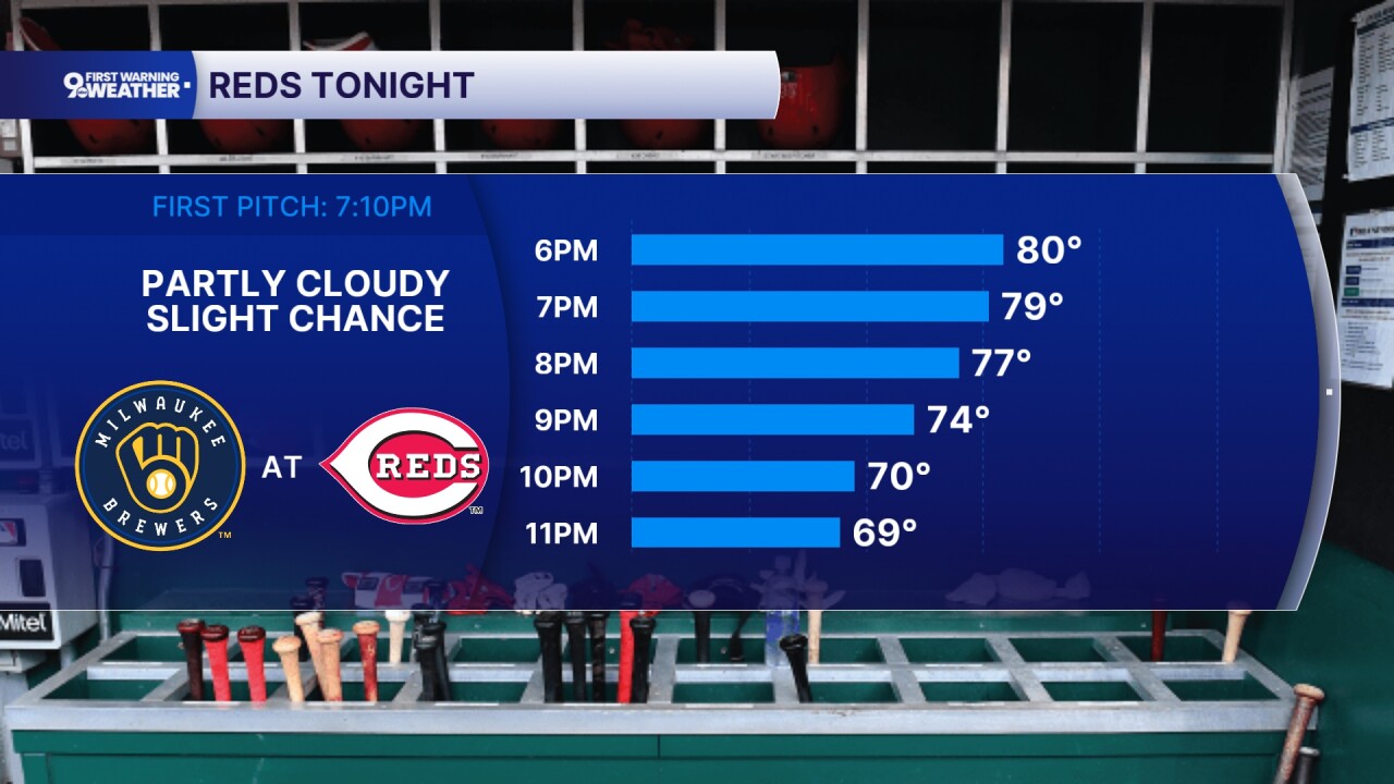
Temperatures start around 60 degrees under a mostly clear sky. We'll warm to 80 this afternoon under a mostly sunny sky. Dew points are still on the lower side so it still doesn't feel too humid outside.
A few more clouds will roll in tonight as temperatures cool to 63 degrees. Moisture is also starting to build a bit back into our area.
Thursday's forecast will bring back the chance for a few showers and storms. It definitely won't be a washout. There's a slight rain chance in the morning hours and then about a 30% to 40% chance for showers in the afternoon hours as well. But we'll see more dry time than anything. Highs increase to 83 degrees and humidity is rising as well.
Rain is likely to move in for Thursday night. Widespread showers and isolated storms will continue into Friday morning, potentially impacting the morning drive. Rounds of showers will continue well into midday and the afternoon timeframe. Highs increase to 80 degrees on Friday. The rain chance does look lower in the evening hours, which could work out nicely for your Friday evening plans.

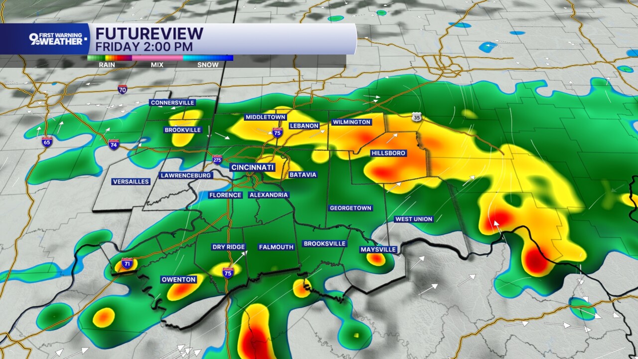
As it stands right now, we are not expecting severe storms on Friday, but heavy rain will be possible in our area.
Rounds of showers will continue on Saturday as well. There's a 60% to 70% chance for rain throughout the day, so consider alternatives if your plans take you outdoors.
MORNING RUSH
Few clouds
Pleasant
Low: 60
WEDNESDAY
Mostly sunny
Not too humid
High: 80
WEDNESDAY NIGHT
Partly cloudy
Mild again
Low: 63
THURSDAY
Partly cloudy, warmer
Isolated afternoon storms
High: 83
THURSDAY NIGHT
Rain likely
A few storms
Low: 65
9 First Warning Weather 24/7 Livestream
==========
- Interactive Radar: Track weather to your doorstep
- Sign up for severe weather email alerts
- Check latest school closings and delays
- WCPO traffic updates
- Metro bus detours and updates (or call the hotline at 513-632-7538)
- Latest power outages from Duke Energy
- Flight cancellations and delays from CVG, other U.S. airports
