


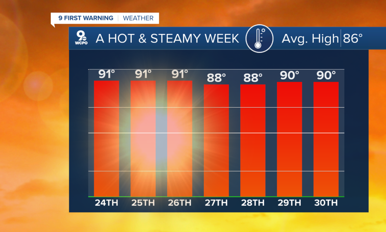
Chalk up another hot and steamy day around the Tri-State as we hit 90°, or more, again for the 9th time this month on Wednesday. However, the heat is coming to an end, and below normal temps are next up for us!
What I'm calling a "heatwave breaker" hits on Thursday as a frontal boundary triggers isolated showers and storms mainly during the afternoon and early evening. While we have a 30% chance of wet weather earlier in the day, it's more likely starting around 3 pm.
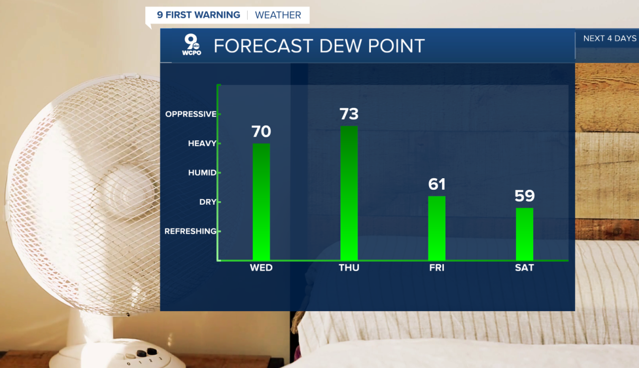
After the system pushes off to the southeast, milder and drier conditions filter into the Tri-State starting on Friday and continuing into the weekend. Temperatures will be in the 70s for most of the day with low humidity.
OVERNIGHT
Mostly clear
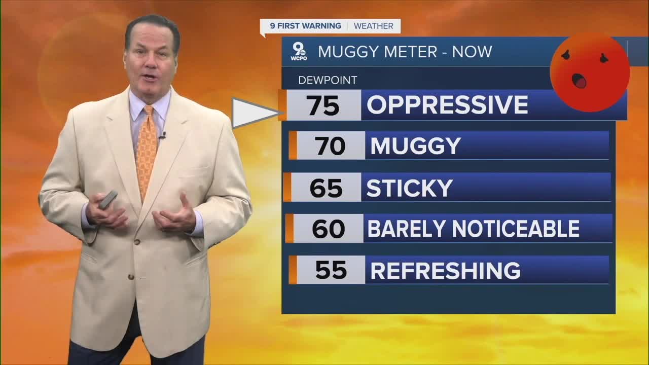
Still humid
Low: 72
THURSDAY
Chance rain early
Then scattered afternoon storms
High: 83
THURSDAY NIGHT
Gradual clearing
More comfortable
Low: 65
9 First Warning Weather 24/7 Livestream
==========
- Interactive Radar: Track weather to your doorstep
- Sign up for severe weather email alerts
- Check latest school closings and delays
- WCPO traffic updates
- Metro bus detours and updates (or call the hotline at 513-632-7538)
- Latest power outages from Duke Energy
- Flight cancellations and delays from CVG, other U.S. airports
