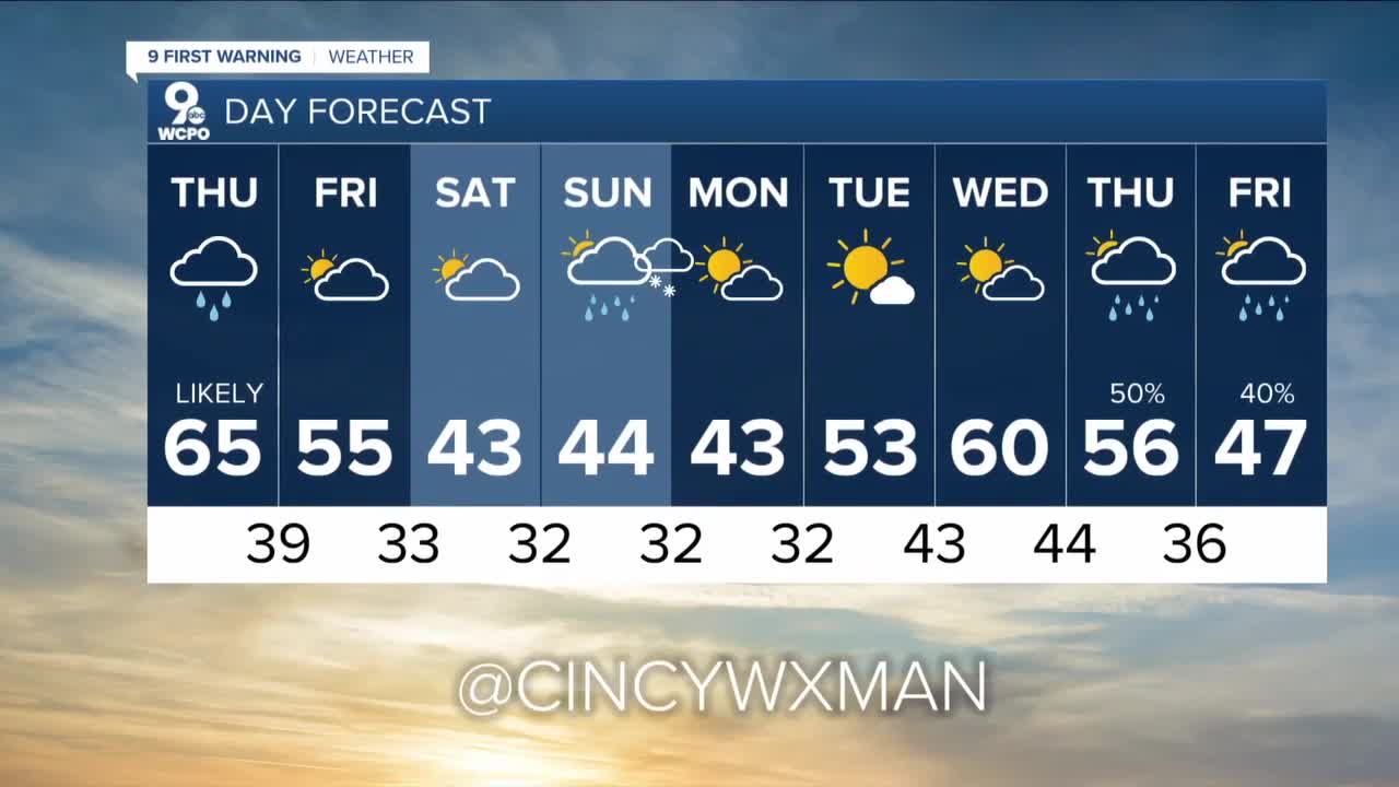


Rain and a few isolated thunderstorms return on Veterans Day as a strong cold front moves across the area in the afternoon. Plus, winds will gust to near 35mph. It'll be a wild afternoon.
Then, winterlike air will move in giving us a chance for a few snowflakes late Friday night and again on Sunday night into Monday.
It will be mild on our Thursday as highs reach the low to mid 60s before the wet weather moves in after 1pm around Greater Cincinnati. At night, rapid clearing will take place leading to partly cloudy skies through Saturday. Highs fall to the low 50s on Friday before winterlike highs in the low 40s this weekend.
While there's a slight chance for a few snowflakes late on Friday, Sunday night a weather maker slides right into the area giving us a reasonable chance to see mixed precipitation. Sunday looks like rain early before the temps drop and we then have a chance for a rain/snow mix. By the weekend, temps will start near freezing both mornings.
TONIGHT
Mostly cloudy
Mild
Low: 50
THURSDAY
Rain develops in the afternoon
Isolated storms possible
Gusty winds to 35mph
High: 65
THURSDAY NIGHT
Rain early
Then clearing
Low: 39
==========
