


It's mostly cloudy skies through daybreak and a lows falling to the low to mid 60s by daybreak. With my overnight low of 64, we could set a record “high” low temperature. Check it out below as we already set one on Friday morning.

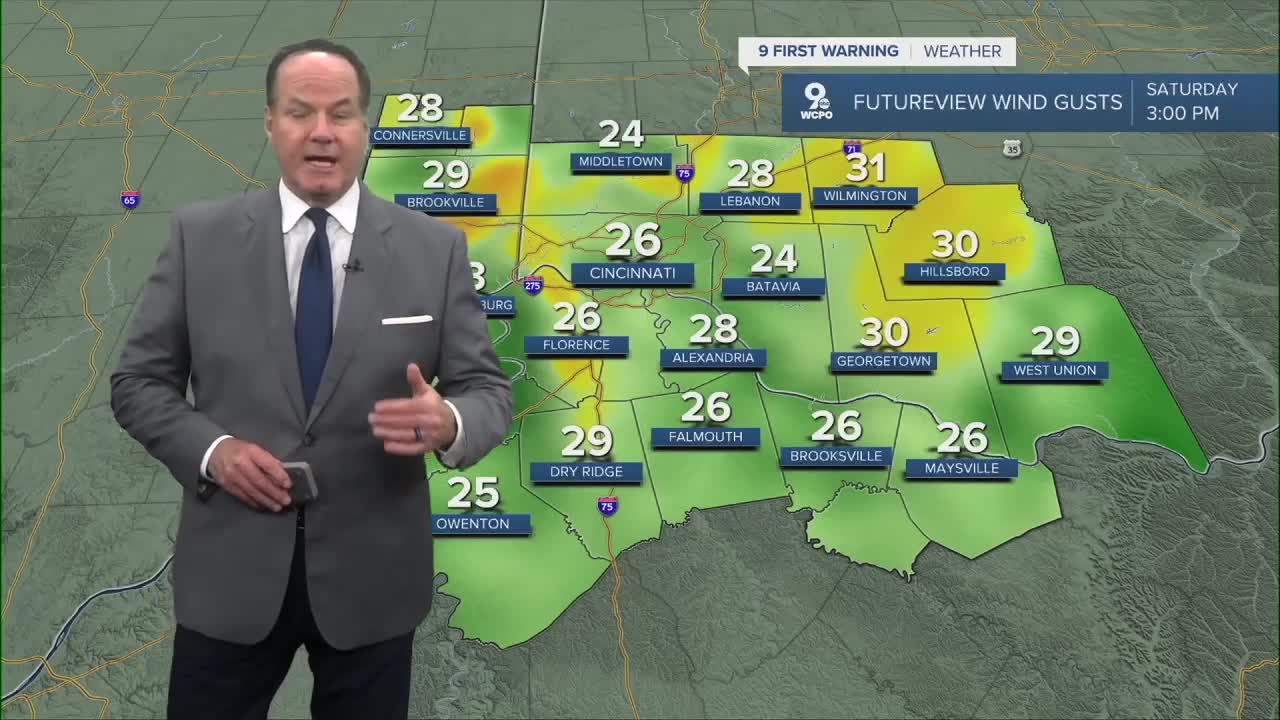
For Saturday, the forecast stays in the warm sector ahead of an approaching cold front. But, I think the conditions should remain mostly dry through the morning and early afternoon before chances for showers and thunderstorms increase late in the afternoon and early evening. Highs will be near 80 degrees and we’ll see southwest wind gusts as high as 30-35 mph.

We do have a “Slight Risk” of severe weather and damaging straight-line winds are the main threat, with some threat for large hail and a small tornado risk if shear and instability overlap better late in the day, Saturday night, showers and possibly a thunderstorm continue and a low around 45,

By Easter Sunday, the front is east and high pressure builds in, bringing mostly sunny skies and a much cooler highs only in the mid 50s with breezy winds to 20-25 mph. A heads up about next week...morning lows could be near freezing on Tuesday & Wednesday morning. Better cover those plants.
OVERNIGHT
Mild and mostly cloudy
Low: 64
SATURDAY
Mostly/partly cloudy early & dry
Showers and storms develop by the afternoon
High: 80
SATURDAY NIGHT
Showers continue
Low: 45
EASTER SUNDAY
Partly Cloudy
& Cooler
High: 55
9 First Warning Weather 24/7 Livestream
==========
- Interactive Radar: Track weather to your doorstep
- Sign up for severe weather email alerts
- Check latest school closings and delays
- WCPO traffic updates
- Metro bus detours and updates (or call the hotline at 513-632-7538)
- Latest power outages from Duke Energy
- Flight cancellations and delays from CVG, other U.S. airports
