


The weather stays quiet and dry overnight, but it will be cool. Cincinnati will drop down into the low 50s for the Monday morning commute. The kiddos will probably want a coat.
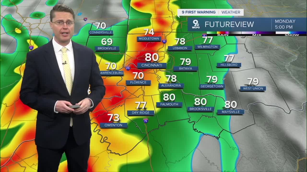
The rest of Monday will be breezy and warmer as most of the Tri-State hits the 80 degree mark. This is assuming we stay dry long enough, which I think we will.
A line of showers and storms will move into the Tri-State from the west, likely in the evening. As the storms arrive, they will be at their strongest, possibly even severe. If there are any areas of severe weather, damaging wind will be the main concern. The storms should continue to weaken as they push farther east. Make sure you bring in any outdoor items you won't want blowing away before the storms arrive.

More waves of showers and storms are expected late Monday night and overnight, but we should be dry by the Tuesday morning commute.
Most of Tuesday will be dry with a mix of sun and clouds in the afternoon. It will be a touch cooler, but still above average, with mid 70s.
A second round of showers and storms will move in from the south late Tuesday night. Rain will likely continue into Wednesday morning. These will come with a very small severe storm threat.

Cooler air blows in behind these two systems, dropping us into the upper 60s for Wednesday afternoon.
We then have a stretch of cool weather. Highs will be in the upper 50s to low 60s Thursday through Sunday. The two coldest mornings will likely be over the weekend with upper 30s to start both days. This will make for a cool and crisp Flying Pig forecast.
Cincinnati should get back into the low 70s early in the next workweek, but more rain is possible next Tuesday.
OVERNIGHT
Mostly clear
Not as chilly
Low: 52
MONDAY
Partly cloudy
Breezy
Storms late
High: 80
MONDAY NIGHT
Mostly cloudy
Rain and storms
Low: 62
TUESDAY
Partly cloudy
Storms late
High: 75
9 First Warning Weather 24/7 Livestream
==========
- Interactive Radar: Track weather to your doorstep
- Sign up for severe weather email alerts
- Check latest school closings and delays
- WCPO traffic updates
- Metro bus detours and updates (or call the hotline at 513-632-7538)
- Latest power outages from Duke Energy
- Flight cancellations and delays from CVG, other U.S. airports
