


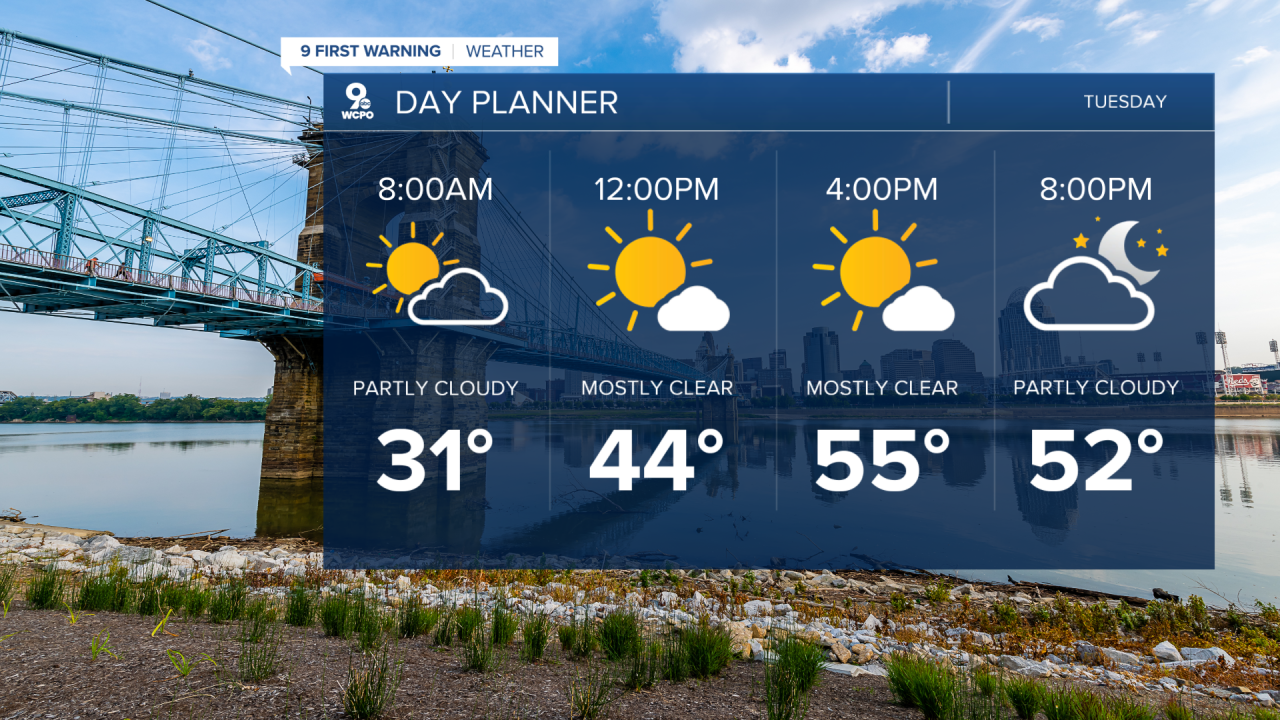
Get ready for a cold morning as we drop into the upper 20s and low 30s across the Tri-State with mostly clear skies.
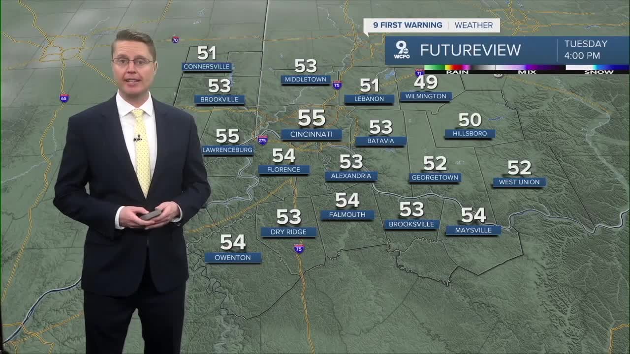
We start to warm back up Tuesday afternoon with a lot of sunshine. Highs will be in the mid 50s, getting us back to average.
The warm-up continues Wednesday with mid 60s. Most of the day will be dry, but we could start to see a few pockets of rain late Wednesday night.
The hit and miss rain will continue into Thursday morning. It won't be for everyone, and it should be dry by the start of the Opening Day parade. Thursday also brings one of our warmer mornings this week with mid 50s.
Thursday afternoon continues to look dry! The combination of some afternoon sunshine and stronger wind out of the southwest will help to push temperatures into the upper 70s.
It's still very possible all 9 innings of the Reds game will be dry, but a cold front is still on track to bring a line of showers and storms Thursday night. A couple of these storms could even reach severe levels.

Some of the rain could continue into Friday morning. The afternoon looks drier and cooler with upper 40s.
The weekend gets us back into the 50s. Saturday will be mostly sunny, but Sunday brings a few more clouds and a small chance for rain.
Then, it's back to the 60s for the first half of next week. Rain looks most likely Tuesday.
OVERNIGHT
Mostly clear
Cold
Low: 31
TUESDAY
Mostly sunny
Seasonal
High: 56
TUESDAY NIGHT
Partly cloudy
Not as cold
Low: 39
WEDNESDAY
Mostly cloudy
Rain possible late
High: 66
9 First Warning Weather 24/7 Livestream
==========
- Interactive Radar: Track weather to your doorstep
- Sign up for severe weather email alerts
- Check latest school closings and delays
- WCPO traffic updates
- Metro bus detours and updates (or call the hotline at 513-632-7538)
- Latest power outages from Duke Energy
- Flight cancellations and delays from CVG, other U.S. airports
