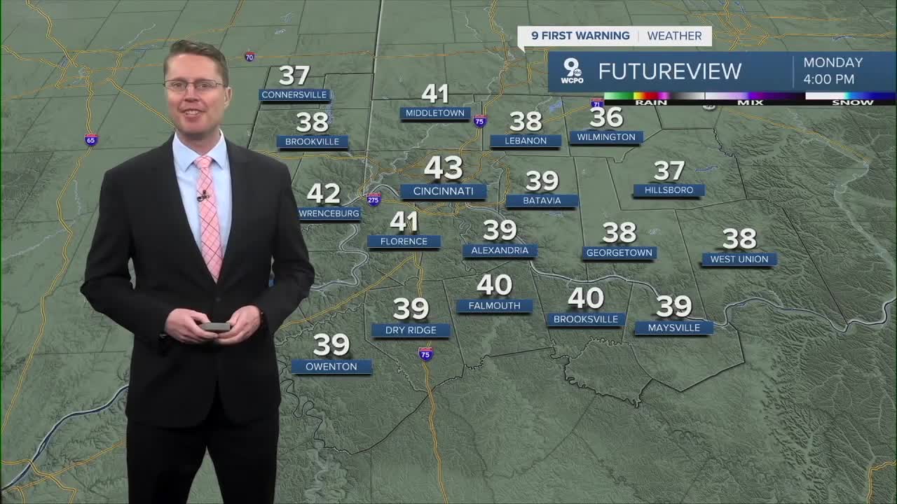


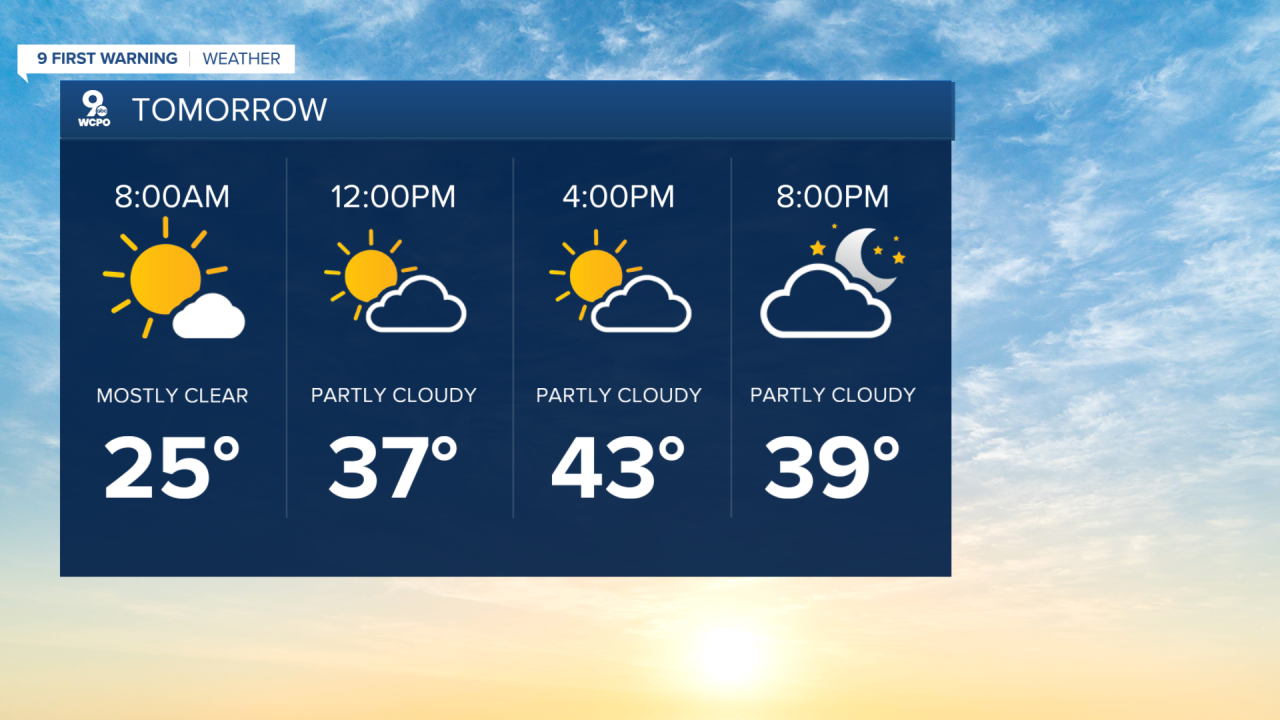
The wind has lightened up, but we get cold heading into Monday morning. Temperatures will start the day in the mid 20s, so the kids will need their winter coats heading to school.
We push a touch above average Monday afternoon with the help of more sunshine and stronger wind out of the southwest. Highs will be in the low 40s.
Tuesday will be warmer with upper 40s and a mix of sun and clouds.
While most of the day will be dry, a few pockets of light rain will start to move into the Tri-State Tuesday night. Light rain will continue to be possible at times Wednesday, holding us back into the low 40s in the afternoon. Behind a a cold front, the rain will change into light snow for Wednesday night and Thursday morning. Right now, it doesn't look like there will be any significant accumulation.

Thursday afternoon will be mostly cloudy and colder with upper 20s. This will kick off a string of days with temperatures below average as we finish the week.
We will be in the mid 30s Friday afternoon with mostly cloudy skies and a small chance for a few snowflakes.
A bit of wintry mix is possible Saturday, although more of it will fall as light snow compared to light rain. Highs will be near freezing.
We drop into the upper 20s on Sunday with some sunshine.
OVERNIGHT
Clearing skies
Cold
Low: 25
MONDAY
Mostly sunny
Warmer
High: 43
MONDAY NIGHT
Mostly clear
Not as cold
Low: 31
TUESDAY
Partly cloudy
Warmer
High: 49
9 First Warning Weather 24/7 Livestream
==========
- Interactive Radar: Track weather to your doorstep
- Sign up for severe weather email alerts
- Check latest school closings and delays
- WCPO traffic updates
- Metro bus detours and updates (or call the hotline at 513-632-7538)
- Latest power outages from Duke Energy
- Flight cancellations and delays from CVG, other U.S. airports
