



Happy Friday!
We are starting the day with an overcast sky. A cold front is passing through the area this morning, leading to the deck of clouds and winds shifting to the northwest at 10 mph. Temperatures start in the mid to upper 40s.
The sky stays mostly cloudy until the noon hour and then we'll see sky conditions turning partly cloudy this afternoon. Highs top out at 55 degrees. Compared to yesterday's high of 67, you'll notice the difference!
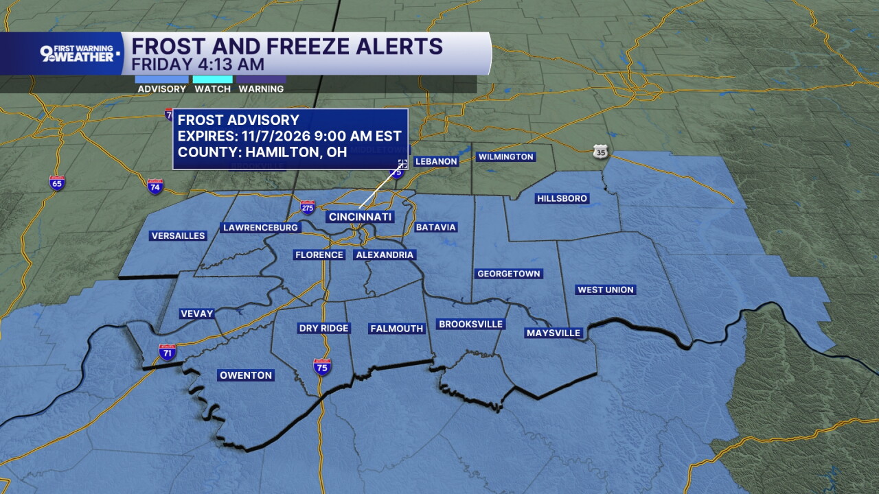
Frost is expected tonight. A frost advisory has been issued from midnight to 9 a.m. You'll notice in the image below that not all counties are included in the advisory. To the north, your first frost of the season has already occurred, so frost advisories aren't issued anymore. Elsewhere, the first frost of the season is quite possible tonight as we drop to 32-35 degrees.
The weekend looks fantastic! We'll top out at 55 on Saturday and 58 on Sunday. Both days will be partly cloudy and dry.
Looking ahead to the extended forecast and the next weather story takes us to late next week. There are signs that even colder air will settle in by the end of the week with highs in the upper 40s.
MORNING RUSH
Overcast
Dry
Low: 47
FRIDAY
Mostly cloudy
To partly sunny
High: 55
FRIDAY NIGHT
Mostly clear
Chilly, frosty
Low: 36
SATURDAY
Partly cloudy
Cool and dry
High: 55
SATURDAY NIGHT
Few clouds
Frost again
Low: 36
SUNDAY
Partly cloudy
Seasonal
High: 58
9 First Warning Weather 24/7 Livestream
==========
- Interactive Radar: Track weather to your doorstep
- Sign up for severe weather email alerts
- Check latest school closings and delays
- WCPO traffic updates
- Metro bus detours and updates (or call the hotline at 513-632-7538)
- Latest power outages from Duke Energy
- Flight cancellations and delays from CVG, other U.S. airports
