


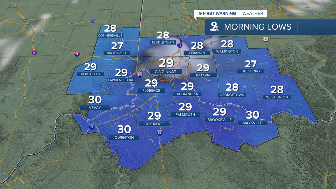
A few clouds continue to linger around the area associated from low pressure pulling off to the east right now. As the low slides east, the clouds will move out allowing for clear skies by daybreak and giving the cold air to really settle in for the morning. Some areas could see some frost. Cover those plants!
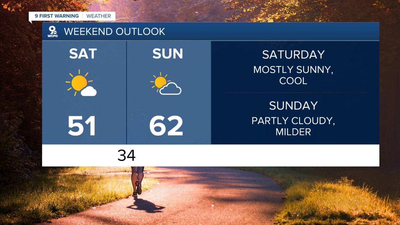
Starting off Saturday morning around the Tri-State, things are looking pretty quiet and cold. You’ll wake up with temperatures in the 30s, but plenty of sunshine will take over through the day. That sunshine helps us recover to the upper 40s to the low 50s by the afternoon, so it’ll feel better compared to the colder start. Winds will be lighter too, making it a bit chilly throughout the day.
As we head into Saturday night, temperatures dip back into the 30s, but the bigger story starts to unfold on Sunday. You’ll notice a big shift as warmer air begins to push into the Ohio Valley. Clouds will mix with some sunshine, and temperatures jump into the mid 60s by the afternoon. That’s a pretty solid warm-up compared to where we’ve been, and it’ll feel a lot more like spring. However, we'll be in and out of clouds for Sunday.
Looking ahead into the rest of the weekend and early next week, the warm-up really takes off. We get a strong push of warmer air, with highs climbing into the 70s by Monday and potentially even pushing toward the low 80s by Tuesday. That’s well above normal for this time of year.
With that warmer air in place, we’ll also start to see more clouds and eventually some chances for rain returning into Monday. But overall, the main headline is the big temperature swing, going from a cool and sunny Saturday to a much warmer, almost early-summer feel by early next week.
OVERNIGHT
Mostly clear
Cooler, frost
Low: 29
SATURDAY
Sunshine
Cool and dry
High: 51
SATURDAY NIGHT
Few clouds
Chilly again
Low: 34
SUNDAY
Partly cloudy
Milder
High: 62
9 First Warning Weather 24/7 Livestream
==========
- Interactive Radar: Track weather to your doorstep
- Sign up for severe weather email alerts
- Check latest school closings and delays
- WCPO traffic updates
- Metro bus detours and updates (or call the hotline at 513-632-7538)
- Latest power outages from Duke Energy
- Flight cancellations and delays from CVG, other U.S. airports
