

Severe storms swept through the Tri-State, producing three tornado warnings earlier this evening. Thankfully, no touchdowns or actual tornadoes were reported. We are set for more rain and storms this week, especially on Wednesday and Thursday.
In the meantime, an isolated shower is possible through Tuesday before a significant area of low pressure triggers plenty of rain. We are currently considered in a moderate drought, so with some luck, this could reduce this situation.

On Wednesday, we have a "Marginal Risk" for severe weather. Rain totals could produce flood advisories with the amount of wet weather in the area. Thursday will see scattered showers again, with a slight chance for rain on Friday morning.

By late Friday, we will dry out, and it appears the weekend will be nice, at this point. Temperatures will be in the mid-70s all week and will rise into the weekend to the upper 70s.
OVERNIGHT
A few showers, chance storms
Overnight fog
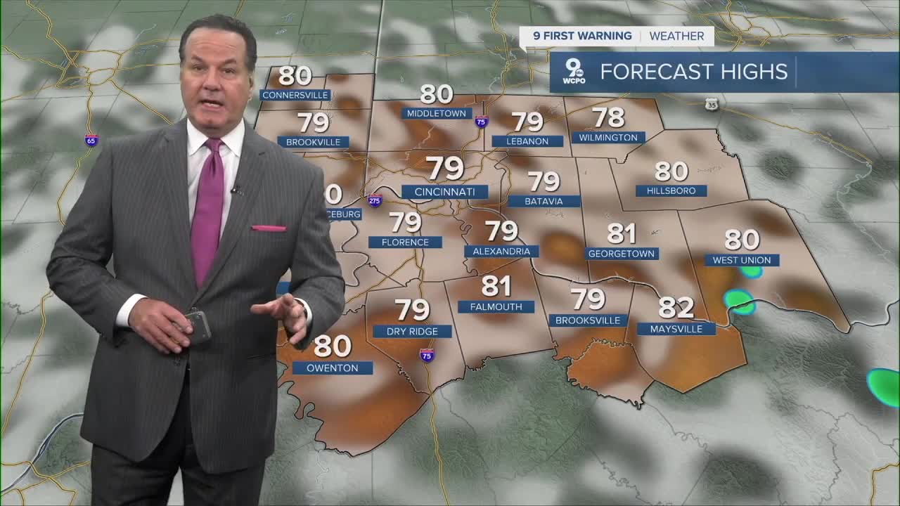
Low: 66
TUESDAY
Mostly cloudy
Few showers
High: 79
TUESDAY NIGHT
Mostly cloudy
Chance for rain
Low: 64
9 First Warning Weather 24/7 Livestream
==========
- Interactive Radar: Track weather to your doorstep
- Sign up for severe weather email alerts
- Check latest school closings and delays
- WCPO traffic updates
- Metro bus detours and updates (or call the hotline at 513-632-7538)
- Latest power outages from Duke Energy
- Flight cancellations and delays from CVG, other U.S. airports
