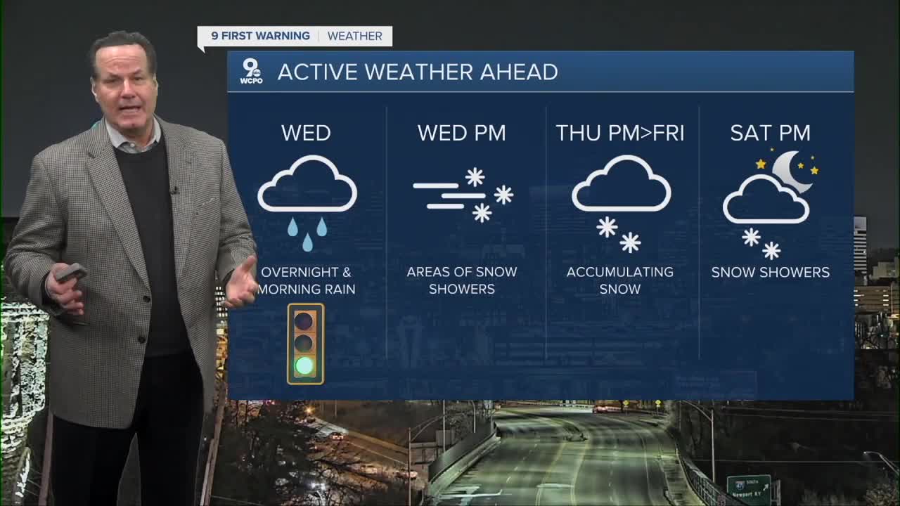


A changeable and potentially disruptive stretch of winter weather is setting up across the Tri-State, and it deserves your full attention. We will likely call for a Weather Alert Day on Friday.
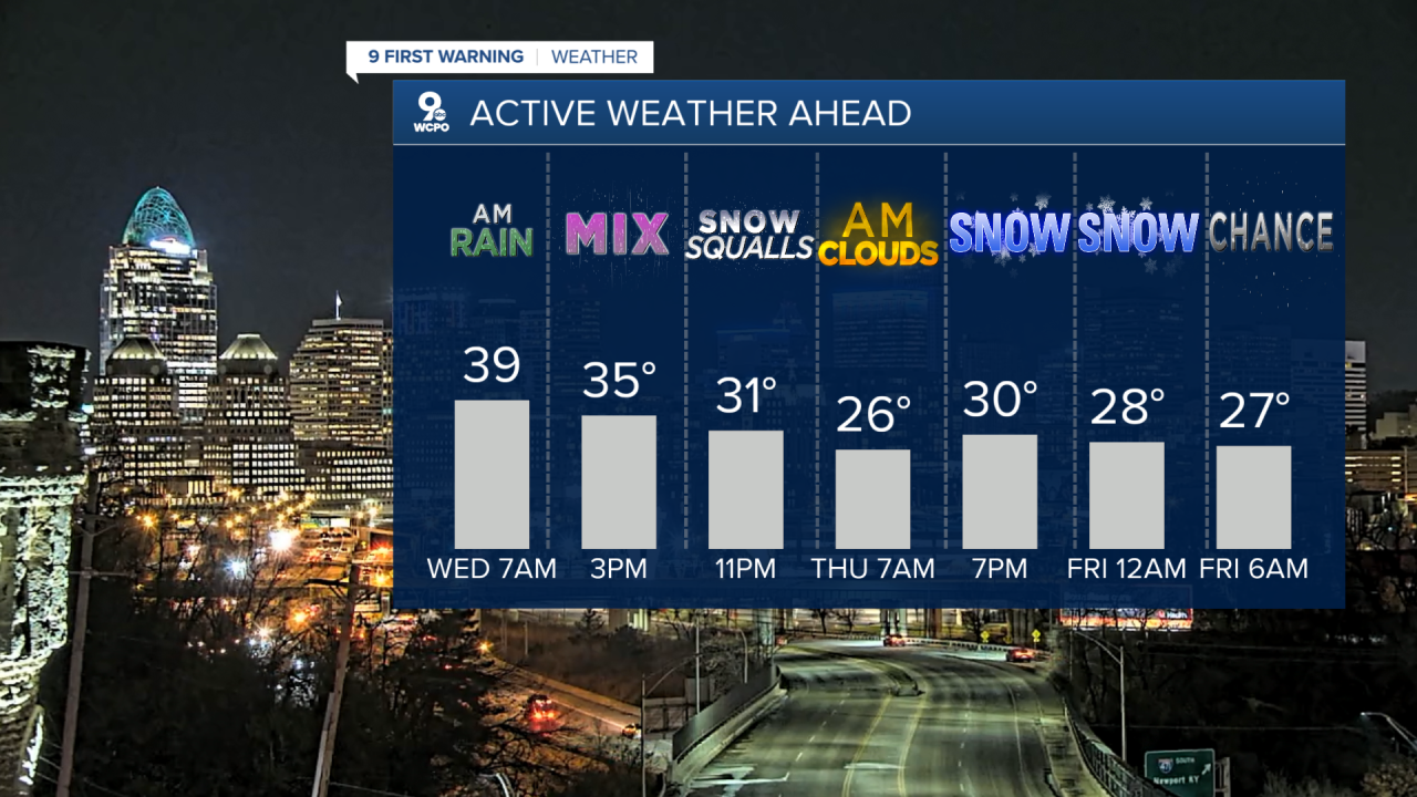
We begin our Wednesday with nothing more than a chilly, steady rain, and temperatures hovering in the upper 30s that will keep the morning commute wet but not wintry. However, that will change quickly. As colder air filters in, rain transitions to snow showers, and with that shift comes the risk for snow squalls.
A snow squall is a short-lived but intense burst of snow accompanied by sudden drops in visibility, rapid light accumulation, and often a quick, sharp drop in temperature. Winds will be gusty to 35mph, which can create conditions that can go from manageable to hazardous in minutes, especially on highways.
After these midday and evening snow showers, we’ll carve out a brief break Thursday afternoon before the more impactful system arrives Thursday night.

Accumulating snow begins as early as 8 PM, becoming moderate at times through about 3 AM. Roads could become slick quickly during this window, and travel disruptions are likely. Snow will begin to taper toward 7 AM Friday, but the story doesn’t end there.
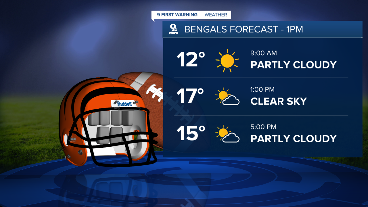
Behind this system, arctic air barrels into the Tri-State, delivering another blast of mid-winter cold. Temperatures drop into the teens on Friday and stay there through the entire weekend, with wind chills even lower. This prolonged stretch of frigid air will affect outdoor plans, travel, and especially Sunday’s Bengals game, where you should prepare for biting cold from kickoff to the 4th quarter.
OVERNIGHT
Rain develops
Overcast
Low: 37
WEDNESDAY
Morning showers
Afternoon mix turning to evening isolated snow showers
Temps falling after noon
Wind gusts to 35mph+
High: 43
WEDNESDAY NIGHT
Isolated show showers likely
Mostly cloudy
Low: 26
9 First Warning Weather 24/7 Livestream
==========
- Interactive Radar: Track weather to your doorstep
- Sign up for severe weather email alerts
- Check latest school closings and delays
- WCPO traffic updates
- Metro bus detours and updates (or call the hotline at 513-632-7538)
- Latest power outages from Duke Energy
- Flight cancellations and delays from CVG, other U.S. airports
