


CINCINNATI — My memories are quite vivid 9 years ago today. In a sentence, it was the worst feeling that I’ve had in 38 years of forecasting. During the worst tornado outbreak ever for the Tri-State, I was delivering weather information in real time. I already knew the kind of devastation that we would find given what I was seeing on our 9 First Warning Doppler.
Tragically, the day was the deadliest single day in Tri-State weather history. Ten people died as 12 tornadoes swarmed the area. An EF-4 swept through Crittenden and Piner, Kentucky, with winds of 175 mph. Two other EF-3 tornadoes recorded winds up to 160 mph.
The weather became all too obvious to our team when the Storm Prediction Center put us in a “High Risk” for severe storms and likely long track tornadoes. We don’t often see that kind of bull's-eye (map below) in the Tri-State.

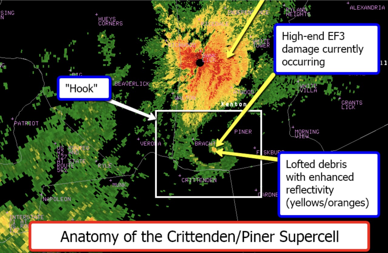
During the event, a so called “debris ball” became evident on radar, which signaled to me the advent of a deadly weather event for the areas around Piner and Crittenden, Kentucky. Four people died when the EF-4 stayed on the ground for 10 miles and was a half-mile wide.
I know I’m not alone remembering that day. It’s the single best reminder to make a safety plan for you and your family. So you are ready for the season ahead.
RELATED: Here's what happened the last time we had this storm outlook
