


A 9 First Warning Weather Alert Day has been issued for Monday morning due to snow and freezing rain.
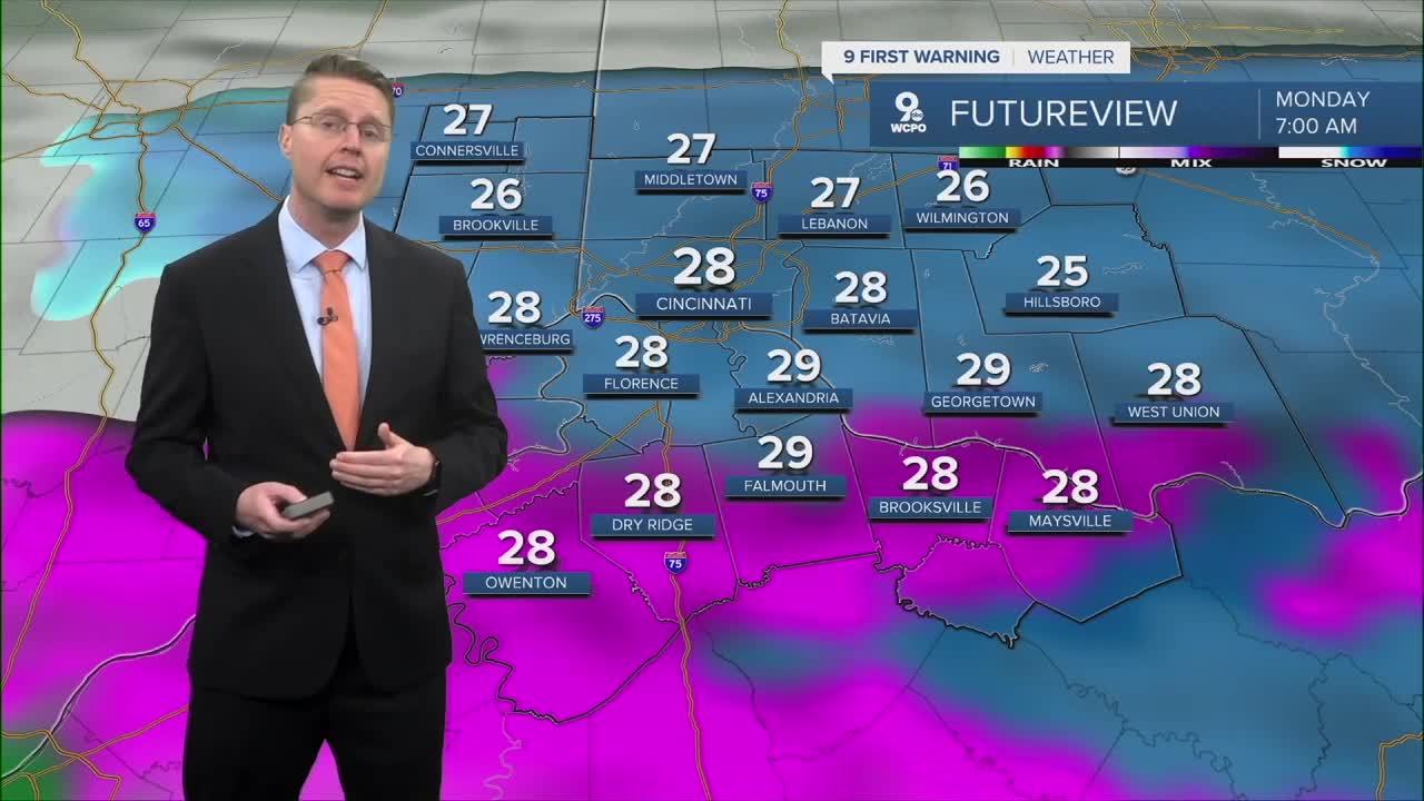
Scattered areas of rain, freezing rain, and snow have started to move into the Tri-State from the west. Before the morning commute, this becomes more widespread, and as temperatures drop into the upper 20s, everything will be freezing rain and snow. Cincinnati and north will see more snow than freezing rain, but areas farther south will see more freezing rain with less snow mixed in.
Snow totals of 1-2 inches will be common north of Cincinnati, but downtown and south have a better chance of seeing an inch of snow at most.

Anyone could see a thin glaze of ice from the freezing rain, but ice totals up to 0.15" are possible in northern Kentucky. This will likely impact the morning commute, so give yourself some extra travel time.

By late morning, any leftover moisture will change into scattered rain as we push back above freezing. The afternoon brings a lot of dry time, but some leftover hit and miss rain will still be around the region. Highs will be near 40 degrees with mostly cloudy skies.
A warm front arrives Tuesday with rain on and off throughout much of the day, but as warmer air blows in, we should reach the upper 50s in the afternoon.

Rain is pretty likely each day the rest of the workweek, but there will be plenty of dry time mixed in too. Through it all, we keep warming up. Wednesday and Thursday will be in the 60s, and then we make it into the low 70s to finish the workweek on Friday.
Rain is likely Saturday with upper 60s. Sunday looks a touch cooler with mid 60s, but right now, the rain doesn't look to be as widespread as other days.
OVERNIGHT
Mostly cloudy
Wintry mix arrives
Low: 28
MONDAY
Mostly cloudy
Wintry mix to rain
High: 40
MONDAY NIGHT
Mostly cloudy
Scattered rain
Low: 39
TUESDAY
Mostly cloudy
Scattered rain
High: 58
9 First Warning Weather 24/7 Livestream
==========
- Interactive Radar: Track weather to your doorstep
- Sign up for severe weather email alerts
- Check latest school closings and delays
- WCPO traffic updates
- Metro bus detours and updates (or call the hotline at 513-632-7538)
- Latest power outages from Duke Energy
- Flight cancellations and delays from CVG, other U.S. airports
