


SUNDAY AND MONDAY ARE 9 FIRST WARNING WEATHER ALERT DAYS!

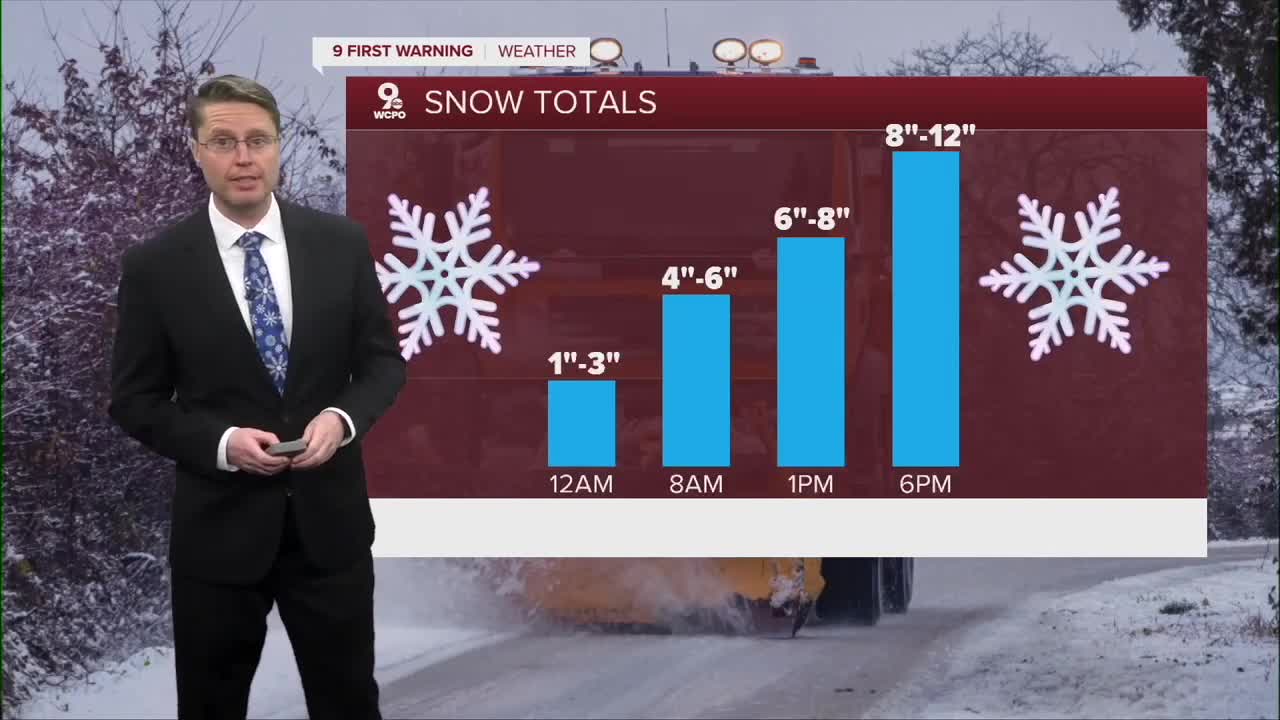
Widespread snow has moved in across the Tri-State as of midnight, and we will continue to see some heavier pockets of snow at times into Sunday morning.
SUNDAY MORNING: By the time the sun rises, we'll likely see 4"-6" of snow on the ground. With the southern half continuing to see slightly higher totals.

SUNDAY: Sunday's forecast is where things get a bit more complicated, and the roads will be difficult or impassable at times.

While we are generally looking at snow throughout the storm, to the south and southeast of Greater Cincinnati, a wintry mix could make an appearance. Our models are showing a wedge of warm air just off the surface, and this could produce sleet or even freezing rain. Along that line of warmer air aloft, though will be some of the highest snowfall rates. If the wintry mix sets up, it will decrease snow totals where it falls.
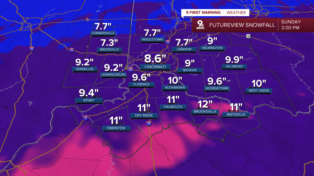
As we move into Sunday evening snowfall rates will start to come down and any leftover snow ends Sunday night. Grand totals will be from 8-12 inches in a lot of spots, but if the storm reaches its full potential, some areas will push over the one foot mark.
While the snow will be ending Sunday night, the impact on travel conditions will continue into Monday morning.
Along with the snow, dangerous cold has settled into the region. Sunday starts in the low double digits and teens. We only warm up to the low 20s for the afternoon.
Monday starts in the single digits with wind chills around -5 to -10. The afternoon will be partly cloudy and frigid with highs struggling to even hit the teens.
Tuesday's morning temperature will be below zero, dropping wind chills into the -10 to -20 range.
The rest of the week will have single digit mornings and highs in the teens and 20s.
A little more snow will also be possible midweek, with the better chance right now looking like late Wednesday.
OVERNIGHT
Snow
Roads becoming difficult
Low: 12
SUNDAY
Moderate to heavy snow
Sleet and freezing rain possible southeast
High: 20
SUNDAY NIGHT
Snow ends early
Dangerous travel
Low: 4
MONDAY
Partly cloudy
Snowy roads
High: 12
9 First Warning Weather 24/7 Livestream
==========
- Interactive Radar: Track weather to your doorstep
- Sign up for severe weather email alerts
- Check latest school closings and delays
- WCPO traffic updates
- Metro bus detours and updates (or call the hotline at 513-632-7538)
- Latest power outages from Duke Energy
- Flight cancellations and delays from CVG, other U.S. airports
