


We could wake up to some foggy areas Sunday as we cool off into the low 60s.
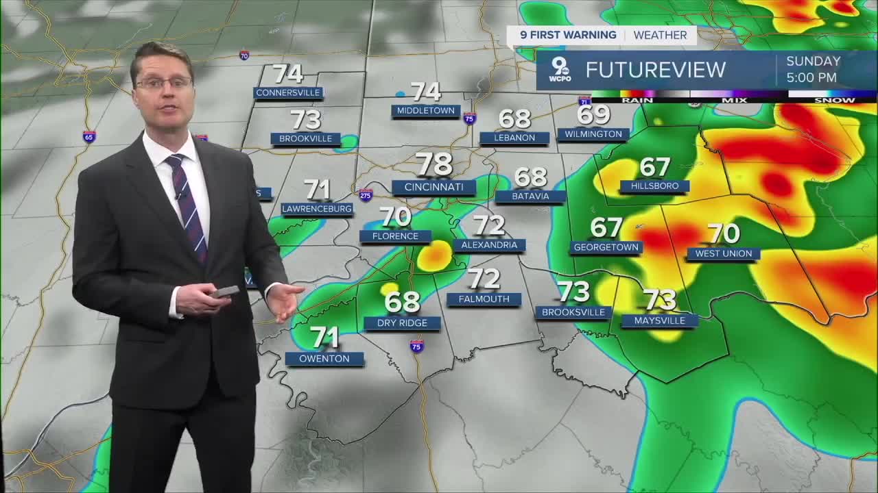
Sunday starts dry for a lot of the Tri-State, but late in the morning, a few spotty showers will start to move back in. Scattered rain, and a few storms, will become more likely as we get later in the afternoon. The rain will keep many spots cooler, but cities that stay dry long enough could hit the upper 70s.

Another round of scattered rain and storms moves in for Memorial Day, but like Sunday, will be more likely in the second half of the day. There won't be as many showers Monday, so a number of spots will stay dry. Have an indoor option ready for any outdoor plans, because at least half of the region will get hit by some of the rain. Dry areas will warm into the upper 70s.
While there will be a few spotty showers around Tuesday, a majority of the Tri-State will be dry with upper 70s and a lot of clouds.
Showers and storms will be more widespread Wednesday with most of us seeing the rain. Temperatures will be in the upper 70s again.

Thursday looks mostly cloudy with only a small chance for rain. Highs will be near 80.
We cool off into the mid 70s Friday and Saturday. While Friday looks dry, there could be a few scattered showers on Saturday.
Sunday has a better chance for staying dry with upper 70s.
SUNDAY
Mostly cloudy
Rain and storms
High: 78
SUNDAY NIGHT
Mostly cloudy
Spotty rain
Low: 61
MEMORIAL DAY
Mostly cloudy
Scattered rain/storms
High: 78
9 First Warning Weather 24/7 Livestream
==========
- Interactive Radar: Track weather to your doorstep
- Sign up for severe weather email alerts
- Check latest school closings and delays
- WCPO traffic updates
- Metro bus detours and updates (or call the hotline at 513-632-7538)
- Latest power outages from Duke Energy
- Flight cancellations and delays from CVG, other U.S. airports
