


It's another clear and mild start for the Tri-State, as our Friday afternoon will see the dry and hot conditions that have been prevalent all week.
Highs once again will reach into the upper 80s to lower 90s on Friday, and that will be the peak of this late summer blast of hot weather. By the time we get into the evening hours for Friday night football or the Reds game, temperatures will be in the upper 70s.

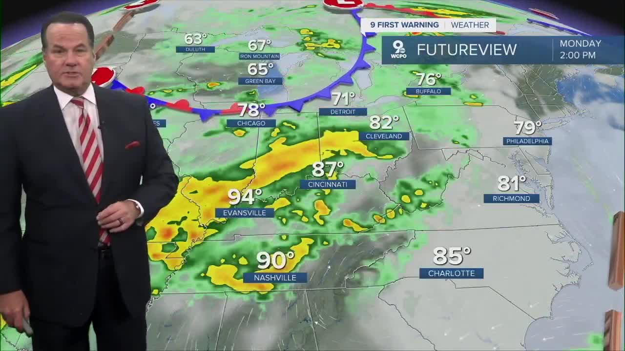
Heat will still be a big element of our weekend forecast. Afternoon highs will climb again to the upper 80s. You'll also notice more clouds returning over this weekend. A complex weather system will finally bring rain to the area. By Sunday evening, isolated showers become a possibility. The wet weather will be likely be Monday.
We certainly could use it, as we are currently in a Moderate Drought as of Thursday. You'll notice that some areas are in the teens when it comes to the percentage of normal rainfall.

This upcoming weather system will keep chances for rain in our forecast every day next week. Unfortunately, it appears that we could only see up to an inch of rain out of the wet weather.
TONIGHT
Mostly clear
Dry
Low: 62
FRIDAY
Mostly sunny
Hot
High: 89
FRIDAY NIGHT
Few clouds
Pleasant
Low: 64
9 First Warning Weather 24/7 Livestream
==========
- Interactive Radar: Track weather to your doorstep
- Sign up for severe weather email alerts
- Check latest school closings and delays
- WCPO traffic updates
- Metro bus detours and updates (or call the hotline at 513-632-7538)
- Latest power outages from Duke Energy
- Flight cancellations and delays from CVG, other U.S. airports
