

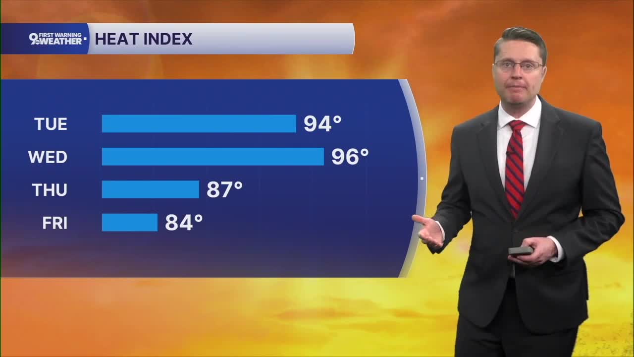



We stay a little warmer overnight, dropping into the upper 60s for Tuesday morning with mostly clear skies.
The heat and humidity continue to climb Tuesday afternoon with a lot of sunshine. Highs will be near 90 degrees in Cincinnati with a heat index in the mid 90s.
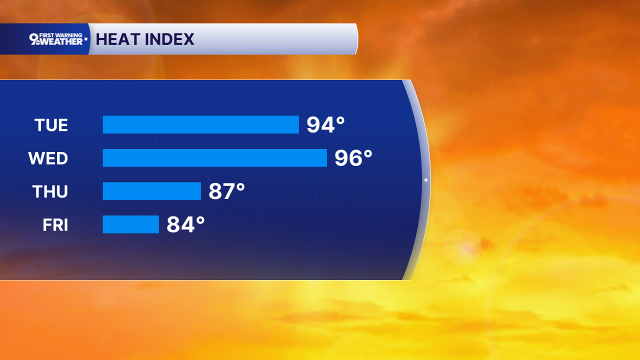
Wednesday looks like the hottest day of the week with low 90s across the Tri-State and mostly sunny skies.
A cold front moving through the Midwest gets close enough to us Wednesday night to throw a few isolated showers and storms at us, but most of us will be dry.
Widespread showers and storms arrive with the cold front Thursday, but there's still some uncertainty on the exact timing of the rain. The heaviest pockets of rain could bring a couple pockets of flash flooding, but widespread problems are not likely. The humidity will still be high, but temperatures drop into the low 80s.
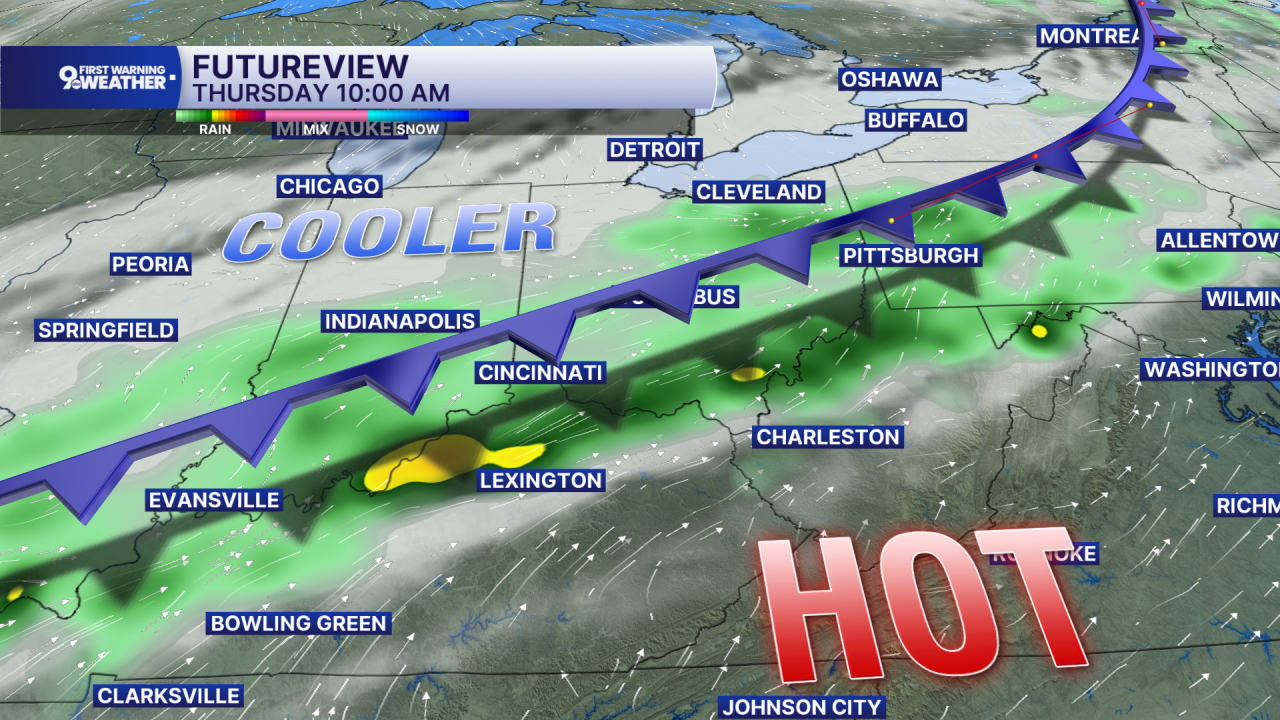
We get a little relief from the high humidity Friday with low 80s.
Unfortunately, we've added a small chance for rain to the forecast on Saturday, but this is far from a guarantee right now. Highs will be in the mid 80s with a mix of sunshine and clouds.
The mid 80s continue Sunday, but there's no threat of rain for the Bengals home opener.
OVERNIGHT
Mostly clear
Not as cool
Low: 68
TUESDAY
Mostly sunny
Muggy
High: 90
TUESDAY NIGHT
Mostly clear
Muggy
Low: 74
9 First Warning Weather 24/7 Livestream
==========
- Interactive Radar: Track weather to your doorstep
- Sign up for severe weather email alerts
- Check latest school closings and delays
- WCPO traffic updates
- Metro bus detours and updates (or call the hotline at 513-632-7538)
- Latest power outages from Duke Energy
- Flight cancellations and delays from CVG, other U.S. airports
