


While we enjoyed pleasant low 60s around the Tri-State on Monday, we are heading into a period where we'll wake up to sub-freezing temps that will have a tough time making it to the 40s for highs!

In the meantime, clear skies and mid to upper 40s will begin on Wednesday. Southwesterly winds will push the afternoon highs into he upper 60s as the gusty winds hit 25-30mph.
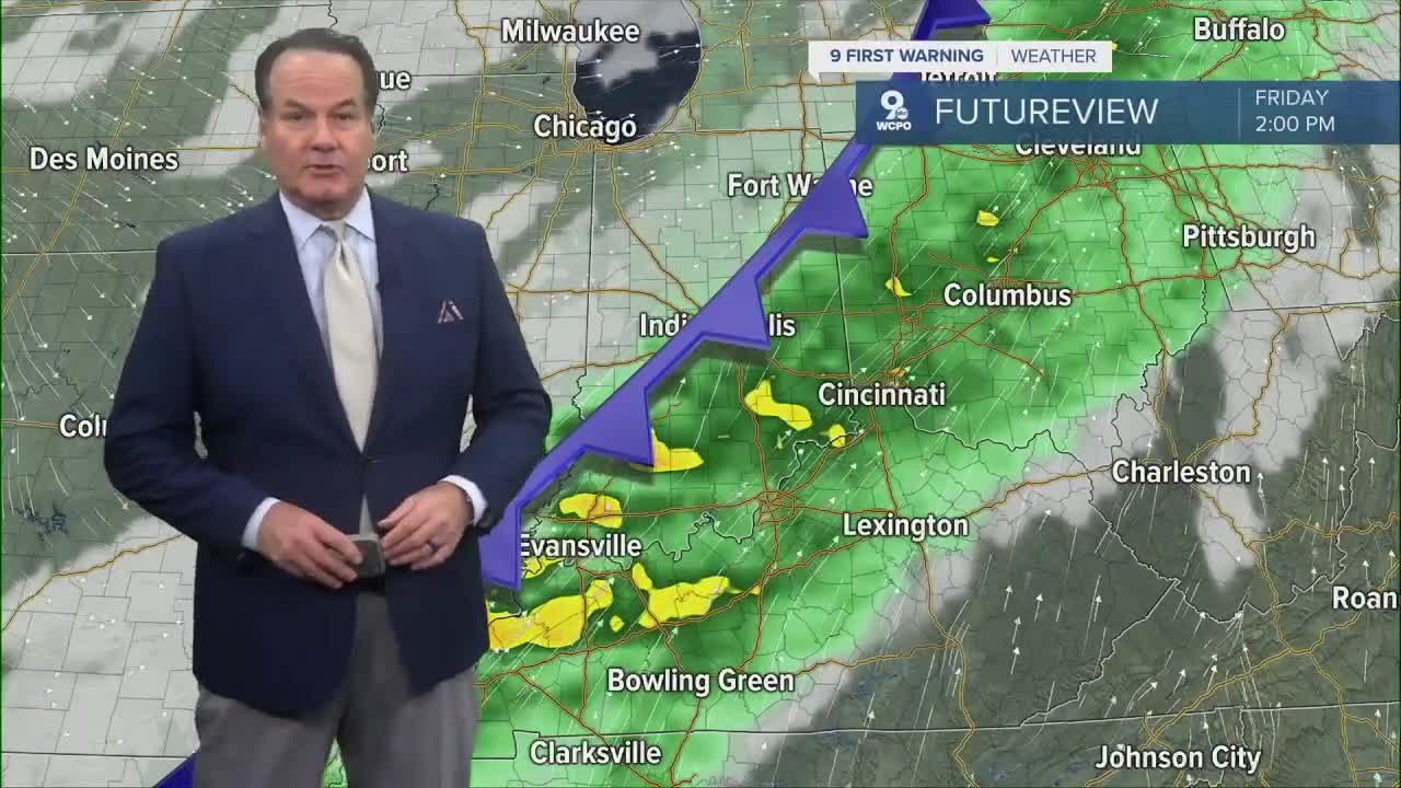
Thursday looks fine, but a bit more seasonal as highs drop back to around 60 degrees before we get wet on Friday. A cold front will swing across the Tri-State during the afternoon and trigger heavy rain, at times.

Another weak front that brings only a chance for rain arrives on Saturday night. More importantly, it will unleash arctic cold air. Temperatures will drop during the day on Sunday into the mid-40s.

It'll bring us a December-like feel on Monday as morning lows start in the mid to upper 20s! Additionally, moisture swept off Lake Michigan could cause snow showers on Monday.
OVERNIGHT
Mostly clear
Not as cold
Low: 47
WEDNESDAY
Mostly sunny
Breezy & warmer
High: 67
WEDNESDAY NIGHT
Few clouds
Cooler
Low: 39
9 First Warning Weather 24/7 Livestream
==========
- Interactive Radar: Track weather to your doorstep
- Sign up for severe weather email alerts
- Check latest school closings and delays
- WCPO traffic updates
- Metro bus detours and updates (or call the hotline at 513-632-7538)
- Latest power outages from Duke Energy
- Flight cancellations and delays from CVG, other U.S. airports
