


By the Monday morning commute, we'll be down to a few leftover flurries. While most of us see little to no accumulation, watch for a couple slick spots where the snow sticks to the roads. Temperatures will fall into the mid 20s, making for a cold start to the day. Wind chills will be in the teens, so make sure the kids have extra layers along with their hats and gloves heading to school.
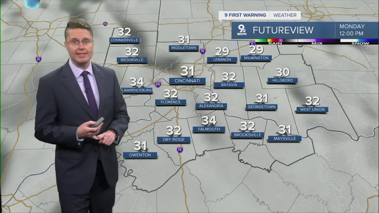
Monday afternoon will be mostly cloudy, a little windy at times, and cold. Highs will be in the low 30s, more than 10 degrees below average in Cincinnati. Wind chills only make it into the mid 20s.

It will still be a little breezy at times Tuesday, but we start to warm back up, pushing closer to 40 with a mix of sun and clouds.
Low 50s look likely Wednesday! By the start of the FC Cincinnati match, we will cool down into the 40s. We're likely dry for the match, but our next round of rain could arrive as early as Wednesday night as an area of low pressure moves east through the Midwest.
Most of the rain will fall Thursday, dropping highs down into the upper 40s for the afternoon. As colder air wraps around the back of the low pressure center, we could see the last bit of rain change into a little snow before completely drying out Thursday night. The widespread snow with the low should stay to our north, but if the low tracks farther south, it would bring better snow chances for the Tri-State.

The sunshine is back Friday, getting us back to 50!
The first half of next weekend looks warmer than the second half. Saturday will be in the upper 50s, but we drop into the upper 40s for Sunday.
Another storm system will try to bring a little rain or snow our way Sunday and Monday, but for now, we're keeping those chances low.
OVERNIGHT
Mostly cloudy
Spotty snow
Low: 24
MONDAY
Mostly cloudy
Flurries
Windy
High: 33
MONDAY NIGHT
Partly cloudy
Cold
Low: 21
TUESDAY
Partly cloudy
Windy
High: 40
9 First Warning Weather 24/7 Livestream
==========
- Interactive Radar: Track weather to your doorstep
- Sign up for severe weather email alerts
- Check latest school closings and delays
- WCPO traffic updates
- Metro bus detours and updates (or call the hotline at 513-632-7538)
- Latest power outages from Duke Energy
- Flight cancellations and delays from CVG, other U.S. airports
