

A Flash Flood Warning is in effect for Warren and Clinton counties until 1:30 a.m. Active flooding is expected in parts of these counties after intense rainfall up to 2 inches.
A Flash Flood Warning is in effect for Hamilton and Butler counties until 1 a.m. At least 2.5 inches of rain has fallen, and active flooding is expected.
Boone County in Kentucky is under a Flood Advisory until 12:45 a.m. Minor flooding in low-lying areas or those with poor drainage can be expected.
The story is now the continuing chance for storms, followed by some partly cloudy skies into Wednesday morning. At 7 am, temperatures will be in the low 70s and muggy with partly to mostly cloudy skies. Then, the rain develops.

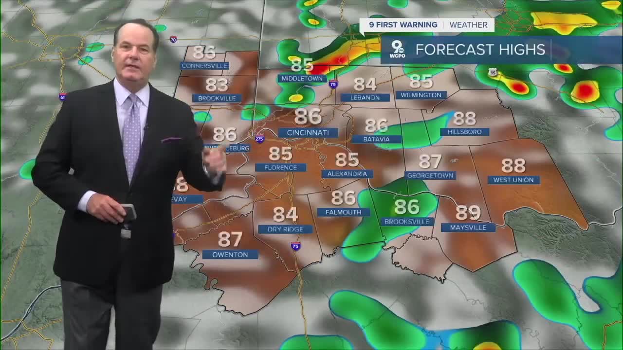
As a front passes through the Tri-State, it will produce scattered thunderstorms with torrential rain that could cause minor flooding, which may trigger a flood advisory in some neighborhoods. We will get a break from the intense heat and humidity as afternoon highs will only reach the low to mid-80s through Thursday.

However, conditions dry out later on Thursday, and the heat ramps back up as we head into the weekend with highs in the 90s again.
OVERNIGHT
Storms ending
Some clearing
Low: 72
WEDNESDAY
Morning chance rain
Then partly cloudy &
Scattered storms
High: 88
WEDNESDAY NIGHT
Storms end
Still muggy
Low: 70
9 First Warning Weather 24/7 Livestream
==========
- Interactive Radar: Track weather to your doorstep
- Sign up for severe weather email alerts
- Check latest school closings and delays
- WCPO traffic updates
- Metro bus detours and updates (or call the hotline at 513-632-7538)
- Latest power outages from Duke Energy
- Flight cancellations and delays from CVG, other U.S. airports
