


Another muggy morning is set for us as we are locked into a heatwave in the Tri-State. I wish I could say it's coming to an end. However, this heat and humidity will last really all week, with only a small interruption by a front bringing rain and storms mid-week.
Monday is back-to-school day for some, and the kiddos will be sweatin'! Afternoons will be in the 90s for most neighborhoods. We do have a slight, isolated chance for a pop-up shower or storm.

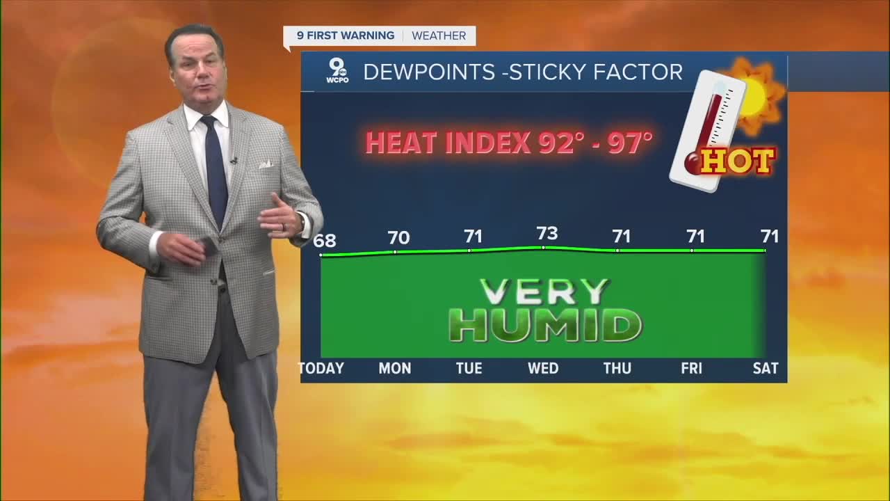
The week will be overall uncomfortable. The Heat Index will run from 92° - 97° all week. The best chance for some relief will be late Tuesday into Wednesday as a front swings near the Tri-State that gives us a 50% chance for rain and thunderstorms.
OVERNIGHT
Mostly Clear
Low: 71
MONDAY
Mostly Sunny
Slight afternoon chance
High: 91
TOMORROW NIGHT
Mostly Clear
more muggy
Low: 71
9 First Warning Weather 24/7 Livestream
==========
- Interactive Radar: Track weather to your doorstep
- Sign up for severe weather email alerts
- Check latest school closings and delays
- WCPO traffic updates
- Metro bus detours and updates (or call the hotline at 513-632-7538)
- Latest power outages from Duke Energy
- Flight cancellations and delays from CVG, other U.S. airports
