

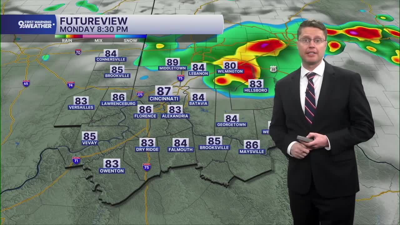



While an isolated shower can't be ruled out overnight, most of us will be dry. The Monday morning commute will be warm and muggy with low 70s to start the day.
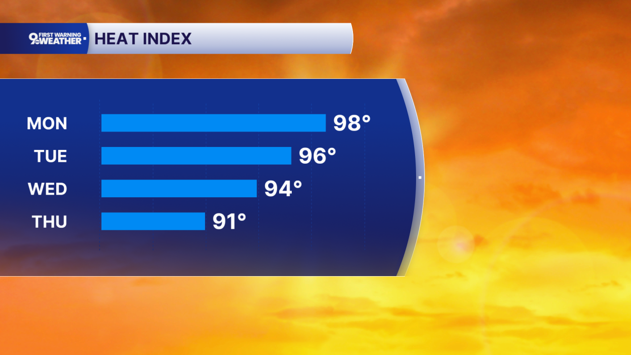
It stays hot and humid Monday afternoon. Highs will be near 90 degrees in Cincinnati, pushing the heat index into the upper 90s with a mix of sun and clouds. A lot of the Tri-State will be dry Monday, but a few scattered storms could make it into the region in the second half of the day. While there won't be many storms, they could be strong to severe. Damaging wind would be the main concern if a severe storm popped up.
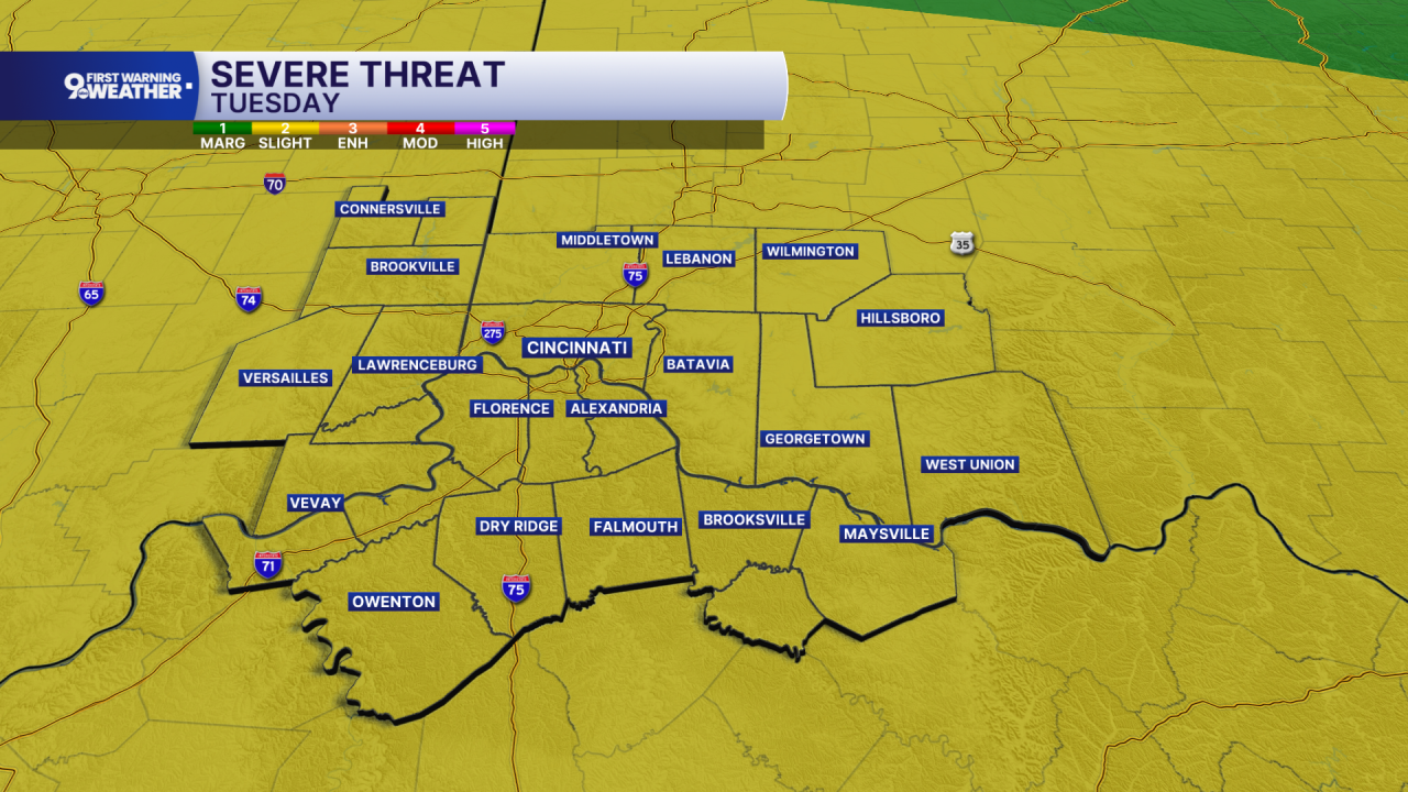
Storms are more likely across the Tri-State Tuesday, which will also come with a small severe storm threat. Highs will be in the upper 80s.
Rounds of storms will likely continue Wednesday, Thursday, and Friday, bringing multiple inches of rain to the area. With this much rain coming, flash flooding will be possible in the heaviest pockets of rain.
We will slowly cool off through the week. Wednesday and Thursday will be in the mid 80s, followed by low 80s for Friday and the weekend.
The forecast also dries out for the weekend, with only a slight chance for rain Saturday and Sunday.
OVERNIGHT
Mostly clear
Muggy
Low: 72
MONDAY
Partly cloudy
Spotty storms
High: 90
MONDAY NIGHT
Partly cloudy
Scattered storms
Low: 72
TUESDAY
Partly cloudy
Scattered storms
High: 88
9 First Warning Weather 24/7 Livestream
==========
- Interactive Radar: Track weather to your doorstep
- Sign up for severe weather email alerts
- Check latest school closings and delays
- WCPO traffic updates
- Metro bus detours and updates (or call the hotline at 513-632-7538)
- Latest power outages from Duke Energy
- Flight cancellations and delays from CVG, other U.S. airports
