


Waking up this morning we have dried out from the overnight showers and storms.
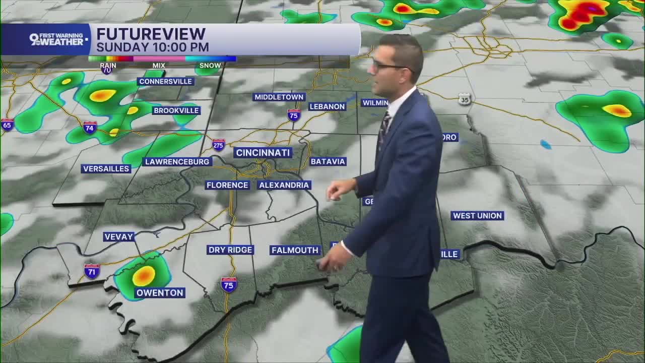
As we go through the afternoon, scattered storms will start to pop up and become more common into the evening. Severe weather is not much of a concern, but a few pockets of flash flooding can't be ruled out.
While a lot of us will get hit by some of this rain, there will be some dry areas too. We'll see more clouds than sunshine, and the heat starts to break, as we only warm into the mid/upper 80s.

The mid 80s, which is average for early July, continue Monday and Tuesday. There will be a mix of sun and clouds with only a very small chance for rain both days.
While the weather stays cooler, the humidity will also drop a touch, helping to lower the heat index early in the week.
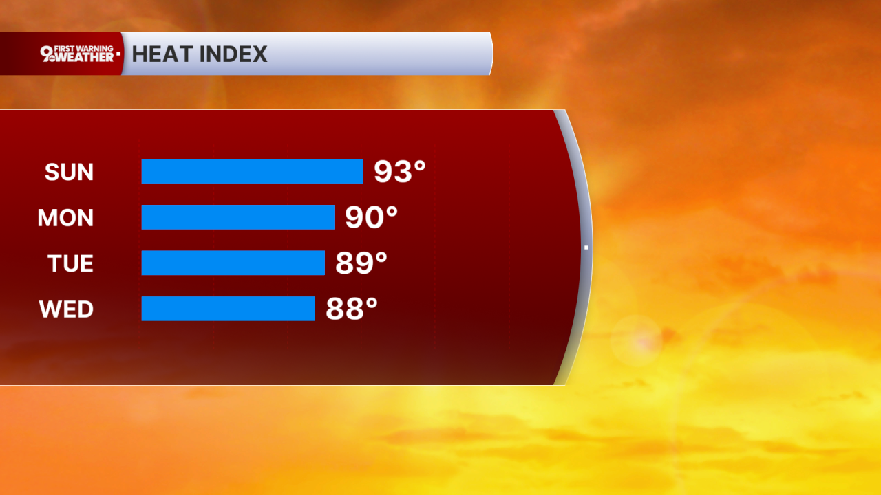
Wednesday will also be partly cloudy with mid 80s.
We could briefly push into the upper 80s Thursday afternoon with a small chance for rain.
Showers and storms look more likely Friday, helping to drop us back down into the mid 80s again.
OVERNIGHT
Partly cloudy
Isolated rain
Low: 70
SUNDAY
Mostly cloudy
Scattered storms
High: 86
SUNDAY NIGHT
Partly cloudy
Drying out
Low: 69
MONDAY
Partly cloudy
Isolated rain
High: 84
9 First Warning Weather 24/7 Livestream
==========
- Interactive Radar: Track weather to your doorstep
- Sign up for severe weather email alerts
- Check latest school closings and delays
- WCPO traffic updates
- Metro bus detours and updates (or call the hotline at 513-632-7538)
- Latest power outages from Duke Energy
- Flight cancellations and delays from CVG, other U.S. airports
