


A Flood Watch has been issued for the Tri-State and this will be in effect until 11 a.m. Saturday.

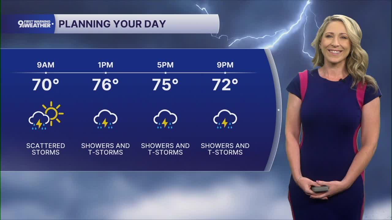
Showers will start moving in Friday morning as scattered activity. As we get closer to noon, a large wave of rain will develop and bring heavier showers and storms during the early afternoon and evening hours. This is also when we could see an isolated strong to severe storm with damaging wind gusts.
Yes, it's a small severe weather risk, but the bigger story is the heavy rain. Highs climb to the upper 70s today and it will be very muggy.

There's a little bit of an update for Saturday's forecast.
The latest weather models coming in this morning are not showing as much widespread rain for the day. We'll still see scattered chances, but it looks like we'll find some dry moments throughout our day. Again, there's a low-end threat for severe weather with damaging wind gusts possible.
Sunday's rain chance still sits at 30% so we'll see more dry time than anything, but it's going to be very muggy regardless. Highs on Sunday will be in the mid 80s.
The big story next week will be the heat and humidity. Rain isn't in the forecast for the time being.
Highs will end up around 90 degrees or higher starting Monday and lasting through the Fourth of July. Heat index values will also be a big talker, rising to 100 to 105 degrees. It looks like the two worst days for heat index values will be Wednesday and Thursday.
MORNING RUSH
Showers move in
Mostly cloudy and muggy
Low: 67
FRIDAY
Showers likely, heavy at times
Storms possible, iso. severe storms
High: 78
FRIDAY NIGHT
Isolated showers
Mostly cloudy, muggy
Low: 67
SATURDAY
Scattered showers
Isolated storms
High: 81
SATURDAY NIGHT
Isolated showers
Mostly cloudy
Low: 66
SUNDAY
Partly cloudy, muggy
Isolated showers and storms
High: 86
9 First Warning Weather 24/7 Livestream
==========
- Interactive Radar: Track weather to your doorstep
- Sign up for severe weather email alerts
- Check latest school closings and delays
- WCPO traffic updates
- Metro bus detours and updates (or call the hotline at 513-632-7538)
- Latest power outages from Duke Energy
- Flight cancellations and delays from CVG, other U.S. airports
