


Strong winds will continue to blow in colder weather tonight. We'll fall to 19 degrees with wind chills in the single digits by daybreak.
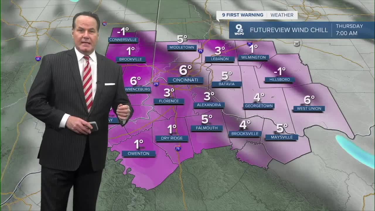
Thursday will be a frigid day. Highs will only be in the mid 20s, but with winds to 20-25 mph, wind chills will make it feel like the teens all day. After a mostly cloudy start to the day, we should see some afternoon sunshine.
As another system arrives on Friday morning, another round of scattered snow is expected. There are some indications of light accumulation to 1/2"-1". We'll keep you posted. Pockets of snow arrive again late at night as another arctic front reinforces the arctic air through next week. Friday will be in the upper 30s, and Saturday sees highs in the low 30s.

Arctic air settles back in behind the early weekend snow, kicking off a stretch of afternoons in the 20s from Sunday through Tuesday. The morning lows will be in the teens or single digits...ouch!
TONIGHT
Isolated snow showers
Mostly cloudy
Low: 19
THURSDAY
Mostly to partly cloudy
Feels like 17 degrees
High: 26
THURSDAY NIGHT
Mostly cloudy
Very cold
Low: 20
FRIDAY
Morning scattered snow showers
High: 38
9 First Warning Weather 24/7 Livestream
==========
- Interactive Radar: Track weather to your doorstep
- Sign up for severe weather email alerts
- Check latest school closings and delays
- WCPO traffic updates
- Metro bus detours and updates (or call the hotline at 513-632-7538)
- Latest power outages from Duke Energy
- Flight cancellations and delays from CVG, other U.S. airports
