



A cold front moves through the Tri-State this morning and it's going to lead to an interesting weather day. We'll see falling temperatures, light showers and breezy winds.
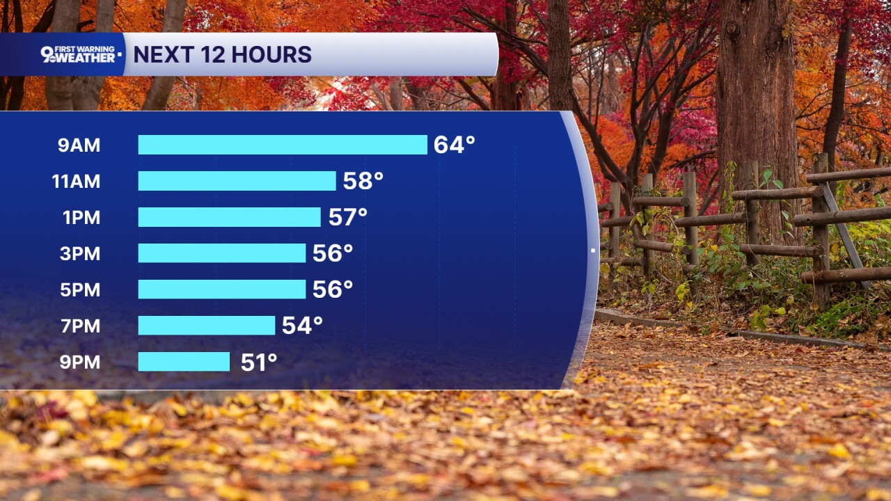
Temperatures start in the mid 60s under a cloudy sky. By noon, temperatures will cool to 57 degrees. Then by 5 p.m., temperatures will only be around 55 degrees. Northwest winds at 15 to 25 mph will be coming in all day long and this leads to the slow drop in temperatures. Wind gusts up to 35 mph are possible.
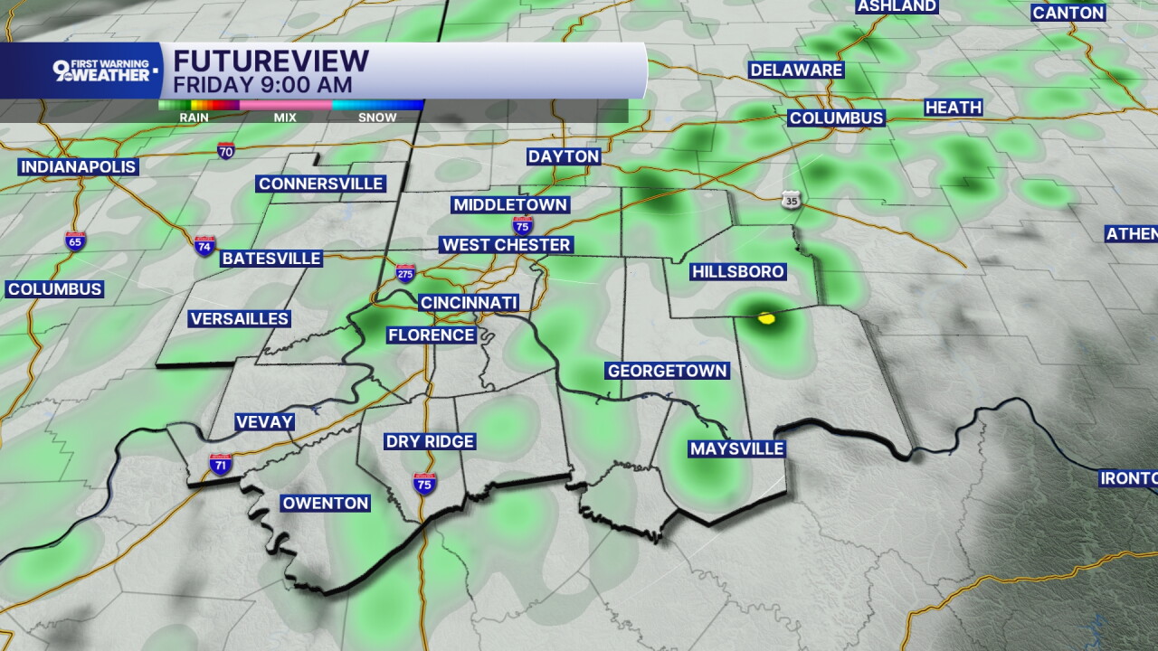
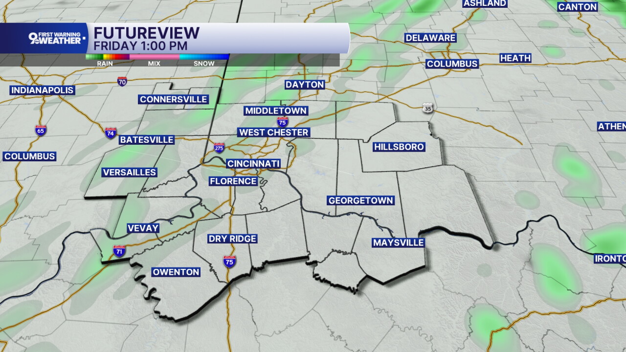
The cold front also brings light rain to our area. We'll see spotty, light rain developing this morning and those spotty showers will continue up through the early afternoon hours. A few stray showers are even possible this evening too.
We'll finally start to see clouds moving out tonight and this will allow temperatures to cool down a lot, not to mention the continued breezy northwest winds. Lows drop to 41 tonight.
Saturday's forecast will be sunny but it's going to be chilly! Highs are only expected in the mid 50s tomorrow. Northeast winds are expected at 10 mph.
Saturday night and Sunday morning will be a 9 First Warning Weather Alert Day as the first frost of Fall is expected. Lows drop to 36 in Cincinnati but outside of the city, many towns will hit freezing. Make sure to cover up or bring in your more sensitive plants!
MORNING RUSH
Overcast, light rain
Warmest air of the day
Low: 65
FRIDAY
Falling temperatures, breezy
Light showers
4 p.m.: 56
FRIDAY NIGHT
Partly cloudy
Much colder
Low: 41
SATURDAY
Sunshine
Below average temps
High: 56
SATURDAY NIGHT
Frost likely, Weather Alert Day
Clear and cold
Low: 36
SUNDAY
Sunshine
Pleasant
High: 62
9 First Warning Weather 24/7 Livestream
==========
- Interactive Radar: Track weather to your doorstep
- Sign up for severe weather email alerts
- Check latest school closings and delays
- WCPO traffic updates
- Metro bus detours and updates (or call the hotline at 513-632-7538)
- Latest power outages from Duke Energy
- Flight cancellations and delays from CVG, other U.S. airports
